
TIP Timpagrande, Italy - Earthquake Result Viewer
| ||||||||||||||||||
| ||||||||||||||||||
| ||||||||||||||||||
|
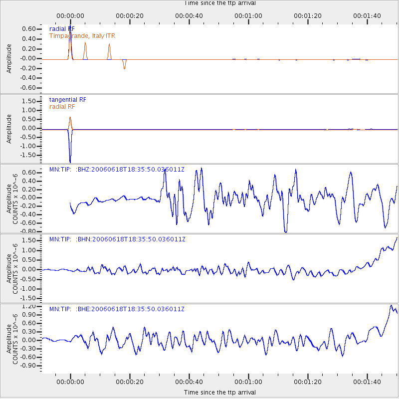
Signal To Noise
| Channel | StoN | STA | LTA |
| MN:TIP: :BHN:20060618T18:35:50.036011Z | 0.71430415 | 9.566979E-8 | 1.3393425E-7 |
| MN:TIP: :BHE:20060618T18:35:50.036011Z | 1.4092466 | 1.9413406E-7 | 1.3775734E-7 |
| MN:TIP: :BHZ:20060618T18:35:50.036011Z | 3.5092607 | 3.1175963E-7 | 8.883912E-8 |
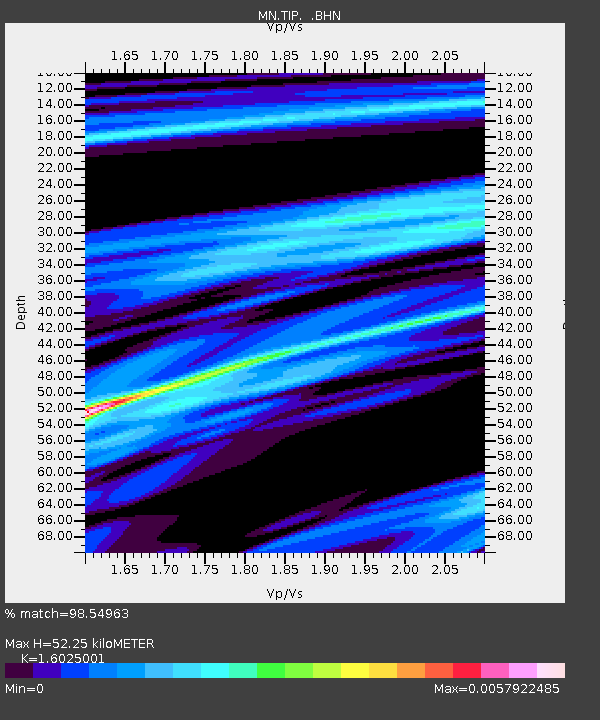
| Arrivals | |
| Ps | 5.5 SECOND |
| PpPs | 21 SECOND |
| PsPs/PpSs | 26 SECOND |

