
TIP Timpagrande, Italy - Earthquake Result Viewer
| ||||||||||||||||||
| ||||||||||||||||||
| ||||||||||||||||||
|
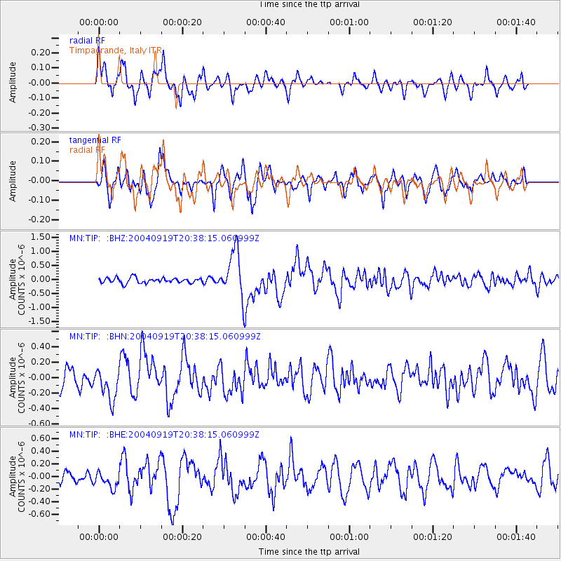
Signal To Noise
| Channel | StoN | STA | LTA |
| MN:TIP: :BHN:20040919T20:38:15.060999Z | 1.8768424 | 2.1530776E-7 | 1.1471809E-7 |
| MN:TIP: :BHE:20040919T20:38:15.060999Z | 1.2103481 | 1.2576967E-7 | 1.0391199E-7 |
| MN:TIP: :BHZ:20040919T20:38:15.060999Z | 9.274109 | 8.6015126E-7 | 9.274759E-8 |
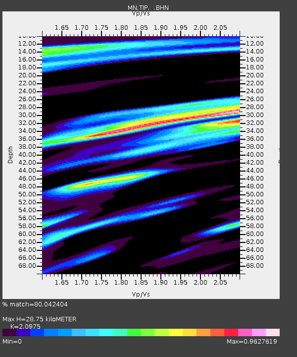
| Arrivals | |
| Ps | 5.3 SECOND |
| PpPs | 14 SECOND |
| PsPs/PpSs | 20 SECOND |

