
TIP Timpagrande, Italy - Earthquake Result Viewer
| ||||||||||||||||||
| ||||||||||||||||||
| ||||||||||||||||||
|
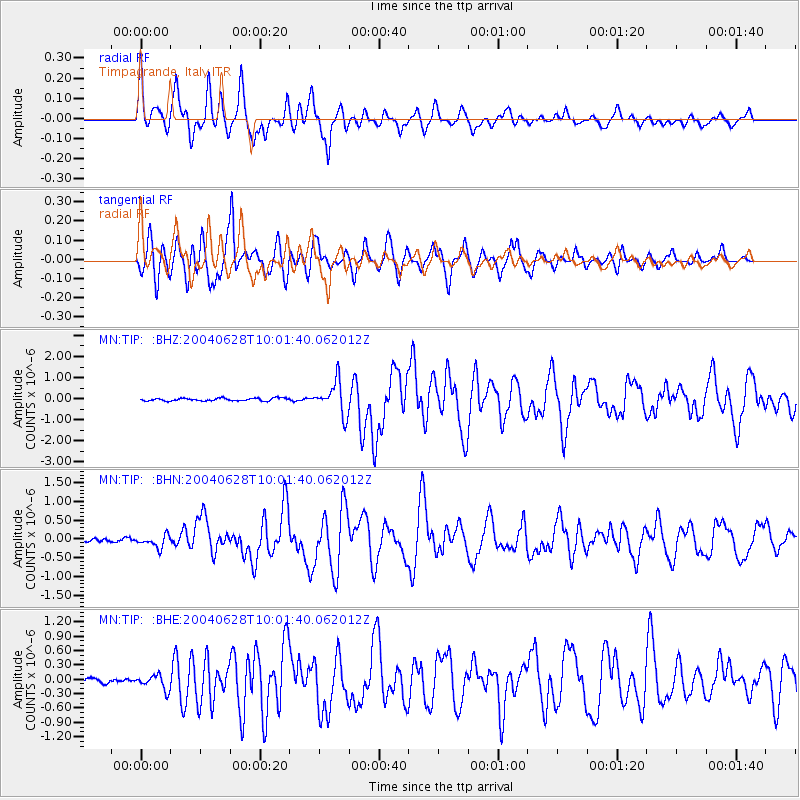
Signal To Noise
| Channel | StoN | STA | LTA |
| MN:TIP: :BHN:20040628T10:01:40.062012Z | 3.8849068 | 1.6470176E-7 | 4.2395293E-8 |
| MN:TIP: :BHE:20040628T10:01:40.062012Z | 4.0230103 | 1.4962735E-7 | 3.7192887E-8 |
| MN:TIP: :BHZ:20040628T10:01:40.062012Z | 12.082708 | 7.688275E-7 | 6.363039E-8 |
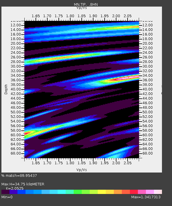
| Arrivals | |
| Ps | 6.1 SECOND |
| PpPs | 17 SECOND |
| PsPs/PpSs | 23 SECOND |

