You are here: Home > Network List > TJ - Tajikistan National Seismic Network Stations List
> Station GARM Garm, Tajikistan > Earthquake Result Viewer
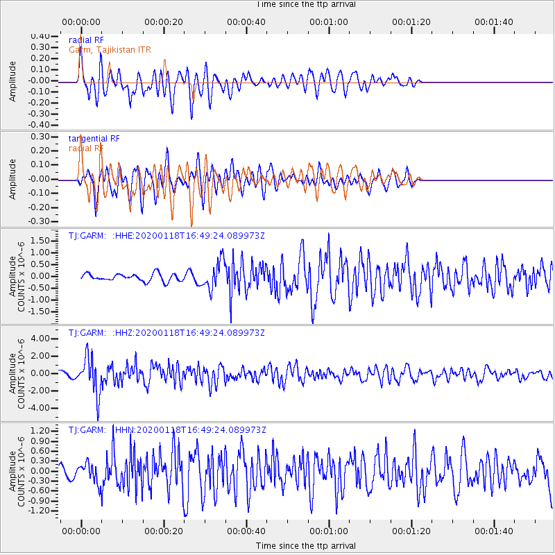
GARM Garm, Tajikistan - Earthquake Result Viewer
*The percent match for this event was below the threshold and hence no stack was calculated.
| Earthquake location: |
Near North Coast Of Irian Jaya |
| Earthquake latitude/longitude: |
-2.9/139.3 |
| Earthquake time(UTC): |
2020/01/18 (018) 16:38:13 GMT |
| Earthquake Depth: |
34 km |
| Earthquake Magnitude: |
6.0 Mww |
| Earthquake Catalog/Contributor: |
NEIC PDE/us |
|
| Network: |
TJ Tajikistan National Seismic Network |
| Station: |
GARM Garm, Tajikistan |
| Lat/Lon: |
39.00 N/70.32 E |
| Elevation: |
1305 m |
|
| Distance: |
75.7 deg |
| Az: |
311.328 deg |
| Baz: |
105.732 deg |
| Ray Param: |
$rayparam |
*The percent match for this event was below the threshold and hence was not used in the summary stack. |
|
| Radial Match: |
73.951195 % |
| Radial Bump: |
400 |
| Transverse Match: |
72.77334 % |
| Transverse Bump: |
400 |
| SOD ConfigId: |
20465011 |
| Insert Time: |
2020-02-01 16:45:36.235 +0000 |
| GWidth: |
2.5 |
| Max Bumps: |
400 |
| Tol: |
0.001 |
|
Signal To Noise
| Channel | StoN | STA | LTA |
| TJ:GARM: :HHZ:20200118T16:49:24.089973Z | 10.476098 | 2.1141195E-6 | 2.018041E-7 |
| TJ:GARM: :HHN:20200118T16:49:24.089973Z | 1.9696944 | 2.8878435E-7 | 1.4661379E-7 |
| TJ:GARM: :HHE:20200118T16:49:24.089973Z | 3.838222 | 6.0507506E-7 | 1.5764462E-7 |
| Arrivals |
| Ps | |
| PpPs | |
| PsPs/PpSs | |


