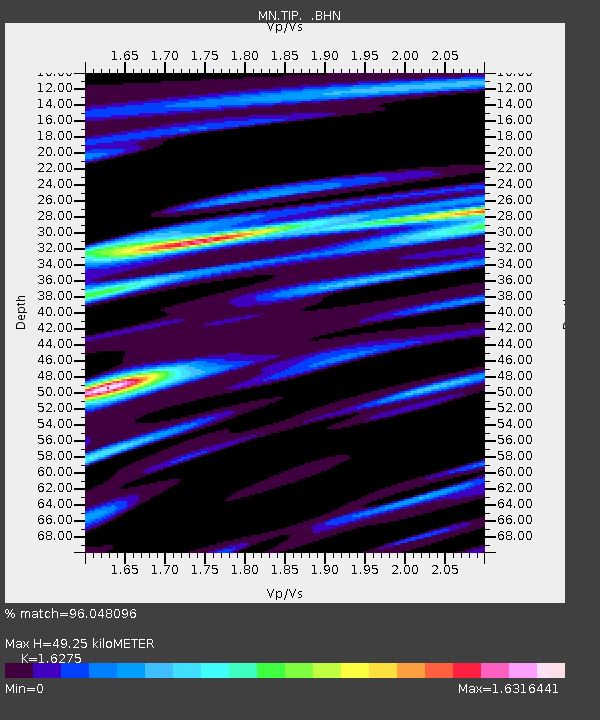
TIP Timpagrande, Italy - Earthquake Result Viewer

Earthquake location: Southern Sumatra, Indonesia
Earthquake latitude/longitude: -2.2/99.8
Earthquake time(UTC): 2008/02/25 (056) 21:02:18 GMT
Earthquake Depth: 25 km
Earthquake Magnitude: 6.2 MB, 6.6 MS, 6.6 MW, 6.5 MW
Earthquake Catalog/Contributor: WHDF/NEIC
Network: MN MEDNET Project
Station: TIP Timpagrande, Italy
Lat/Lon: 39.18 N/16.76 E
Elevation: 789 m
Distance: 86.0 deg
Az: 309.34 deg
Baz: 96.118 deg
Ray Param: 0.04432556
Estimated Moho Depth: 49.25 km
Estimated Crust Vp/Vs: 1.63
Assumed Crust Vp: 6.1 km/s
Estimated Crust Vs: 3.748 km/s
Estimated Crust Poisson's Ratio: 0.20
Radial Match: 96.048096 %
Radial Bump: 336
Transverse Match: 89.80216 %
Transverse Bump: 400
SOD ConfigId: 2564
Insert Time: 2010-03-08 17:21:42.282 +0000
GWidth: 2.5
Max Bumps: 400
Tol: 0.001

Signal To Noise

ChannelStoNSTALTA
MN:TIP: :BHN:20080225T21:14:25.227007Z2.83320573.896538E-71.3753106E-7
MN:TIP: :BHE:20080225T21:14:25.227007Z12.6424738.3947145E-76.640089E-8
MN:TIP: :BHZ:20080225T21:14:25.227007Z13.2134381.8290178E-61.3842104E-7
Arrivals
Ps5.2 SECOND
PpPs21 SECOND
PsPs/PpSs26 SECOND