
TIP Timpagrande, Italy - Earthquake Result Viewer
| ||||||||||||||||||
| ||||||||||||||||||
| ||||||||||||||||||
|
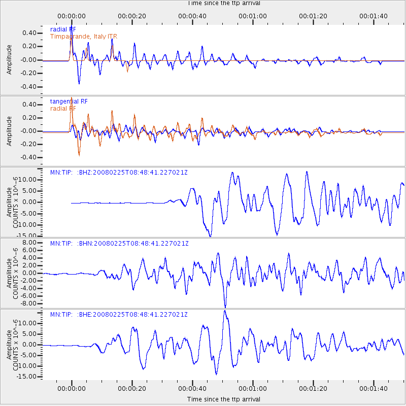
Signal To Noise
| Channel | StoN | STA | LTA |
| MN:TIP: :BHN:20080225T08:48:41.227021Z | 1.2682601 | 1.2656214E-7 | 9.979194E-8 |
| MN:TIP: :BHE:20080225T08:48:41.227021Z | 2.3699913 | 2.677604E-7 | 1.12979485E-7 |
| MN:TIP: :BHZ:20080225T08:48:41.227021Z | 7.755973 | 6.541619E-7 | 8.434299E-8 |
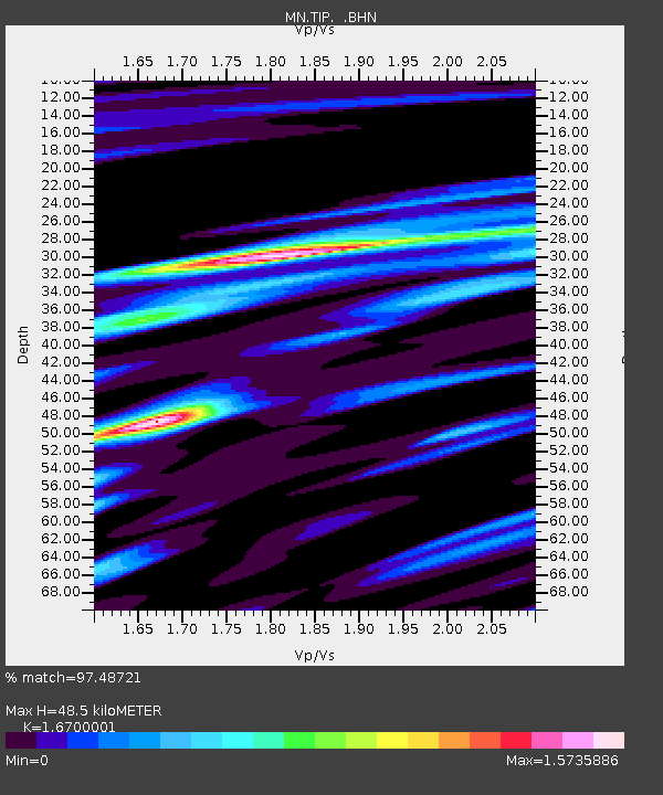
| Arrivals | |
| Ps | 5.4 SECOND |
| PpPs | 21 SECOND |
| PsPs/PpSs | 26 SECOND |

