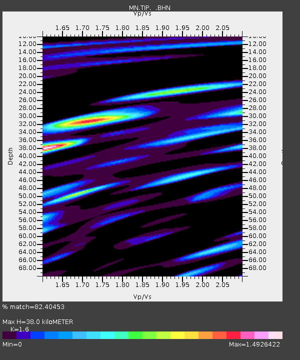
TIP Timpagrande, Italy - Earthquake Result Viewer
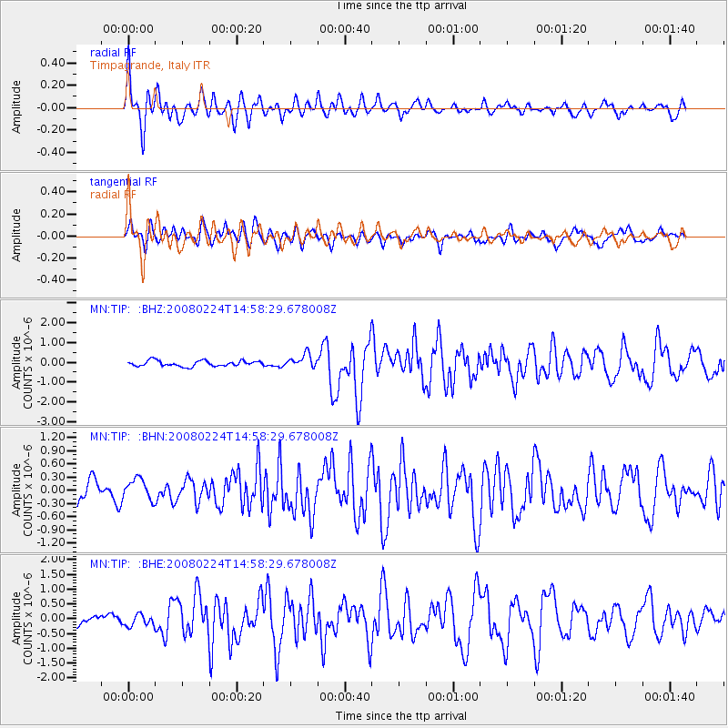
Earthquake location: Southern Sumatra, Indonesia
Earthquake latitude/longitude: -2.4/99.9
Earthquake time(UTC): 2008/02/24 (055) 14:46:21 GMT
Earthquake Depth: 22 km
Earthquake Magnitude: 6.0 MB, 6.4 MS, 6.4 MW, 6.2 MW
Earthquake Catalog/Contributor: WHDF/NEIC
Network: MN MEDNET Project
Station: TIP Timpagrande, Italy
Lat/Lon: 39.18 N/16.76 E
Elevation: 789 m
Distance: 86.2 deg
Az: 309.338 deg
Baz: 96.163 deg
Ray Param: 0.044192523
Estimated Moho Depth: 38.0 km
Estimated Crust Vp/Vs: 1.60
Assumed Crust Vp: 6.1 km/s
Estimated Crust Vs: 3.812 km/s
Estimated Crust Poisson's Ratio: 0.18
Radial Match: 82.40453 %
Radial Bump: 400
Transverse Match: 69.51509 %
Transverse Bump: 400
SOD ConfigId: 2564
Insert Time: 2010-03-08 17:21:45.748 +0000
GWidth: 2.5
Max Bumps: 400
Tol: 0.001

Signal To Noise

ChannelStoNSTALTA
MN:TIP: :BHN:20080224T14:58:29.678008Z0.93693982.4115215E-72.5738277E-7
MN:TIP: :BHE:20080224T14:58:29.678008Z1.26936661.9850826E-71.5638372E-7
MN:TIP: :BHZ:20080224T14:58:29.678008Z2.4540073.4146126E-71.3914436E-7
Arrivals
Ps3.8 SECOND
PpPs16 SECOND
PsPs/PpSs20 SECOND