
TIP Timpagrande, Italy - Earthquake Result Viewer
| ||||||||||||||||||
| ||||||||||||||||||
| ||||||||||||||||||
|
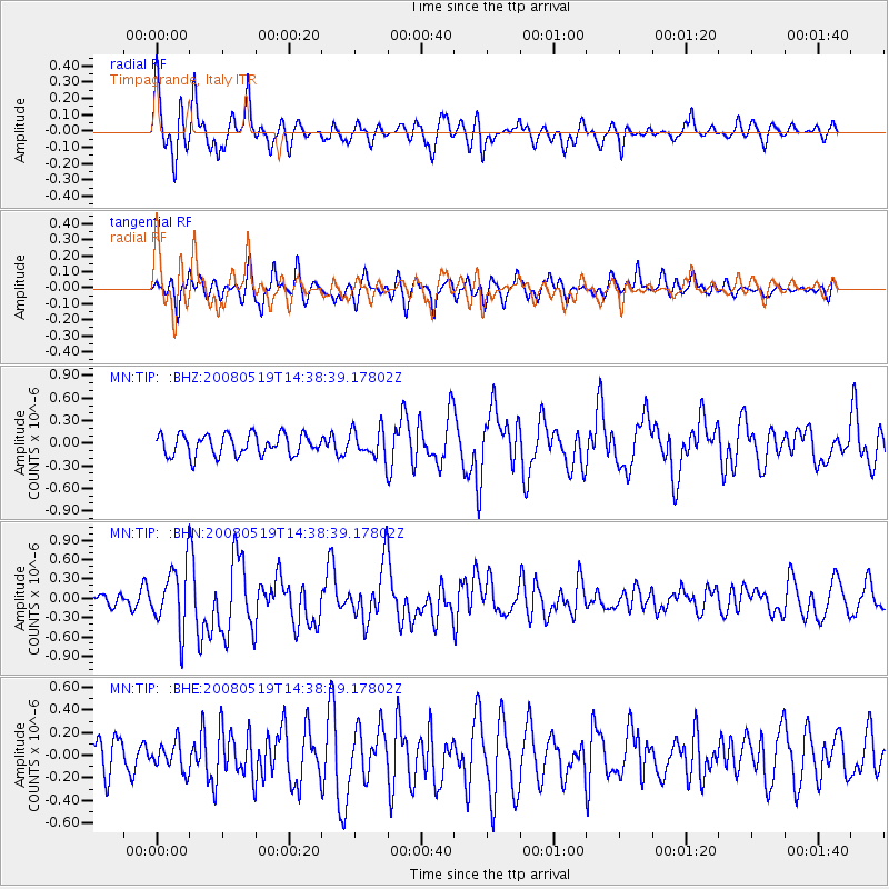
Signal To Noise
| Channel | StoN | STA | LTA |
| MN:TIP: :BHN:20080519T14:38:39.17802Z | 5.69457 | 4.798541E-7 | 8.42652E-8 |
| MN:TIP: :BHE:20080519T14:38:39.17802Z | 0.8653975 | 1.2247925E-7 | 1.4152947E-7 |
| MN:TIP: :BHZ:20080519T14:38:39.17802Z | 1.3337288 | 1.8509151E-7 | 1.3877747E-7 |
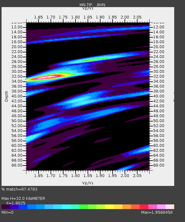
| Arrivals | |
| Ps | 3.7 SECOND |
| PpPs | 14 SECOND |
| PsPs/PpSs | 17 SECOND |

