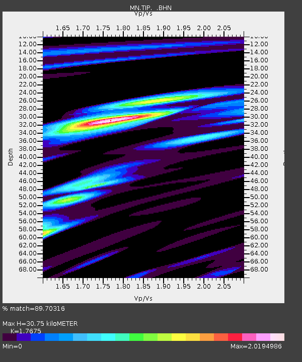
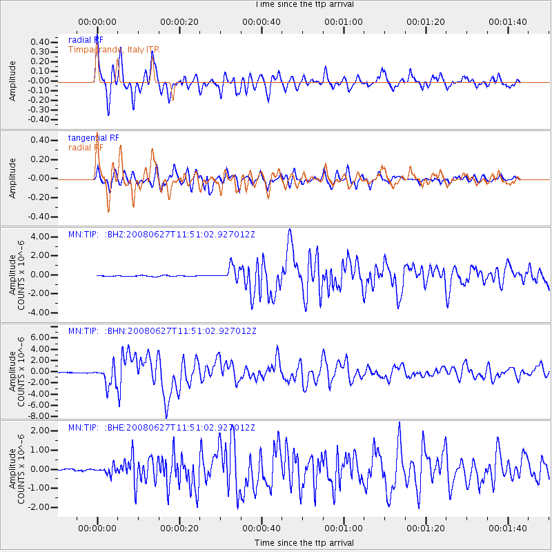
TIP Timpagrande, Italy - Earthquake Result Viewer

Earthquake location: Andaman Islands, India Region
Earthquake latitude/longitude: 11.0/91.8
Earthquake time(UTC): 2008/06/27 (179) 11:40:13 GMT
Earthquake Depth: 17 km
Earthquake Magnitude: 6.4 MB, 6.7 MS, 6.6 MW, 6.6 MW
Earthquake Catalog/Contributor: WHDF/NEIC
Network: MN MEDNET Project
Station: TIP Timpagrande, Italy
Lat/Lon: 39.18 N/16.76 E
Elevation: 789 m
Distance: 71.6 deg
Az: 307.669 deg
Baz: 90.712 deg
Ray Param: 0.054220367
Estimated Moho Depth: 30.75 km
Estimated Crust Vp/Vs: 1.77
Assumed Crust Vp: 6.1 km/s
Estimated Crust Vs: 3.451 km/s
Estimated Crust Poisson's Ratio: 0.26
Radial Match: 89.70316 %
Radial Bump: 400
Transverse Match: 88.05949 %
Transverse Bump: 400
SOD ConfigId: 2504
Insert Time: 2010-03-08 17:22:03.579 +0000
GWidth: 2.5
Max Bumps: 400
Tol: 0.001

Signal To Noise

ChannelStoNSTALTA
MN:TIP: :BHN:20080627T11:51:02.927012Z34.8492551.8272524E-65.243304E-8
MN:TIP: :BHE:20080627T11:51:02.927012Z5.0317481.960301E-73.895865E-8
MN:TIP: :BHZ:20080627T11:51:02.927012Z16.40487.593446E-74.6287948E-8
Arrivals
Ps4.0 SECOND
PpPs14 SECOND
PsPs/PpSs18 SECOND