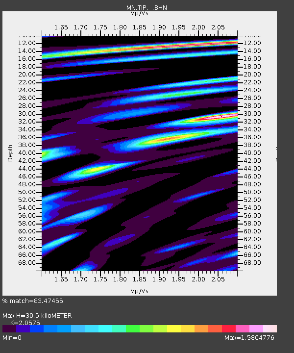
TIP Timpagrande, Italy - Earthquake Result Viewer
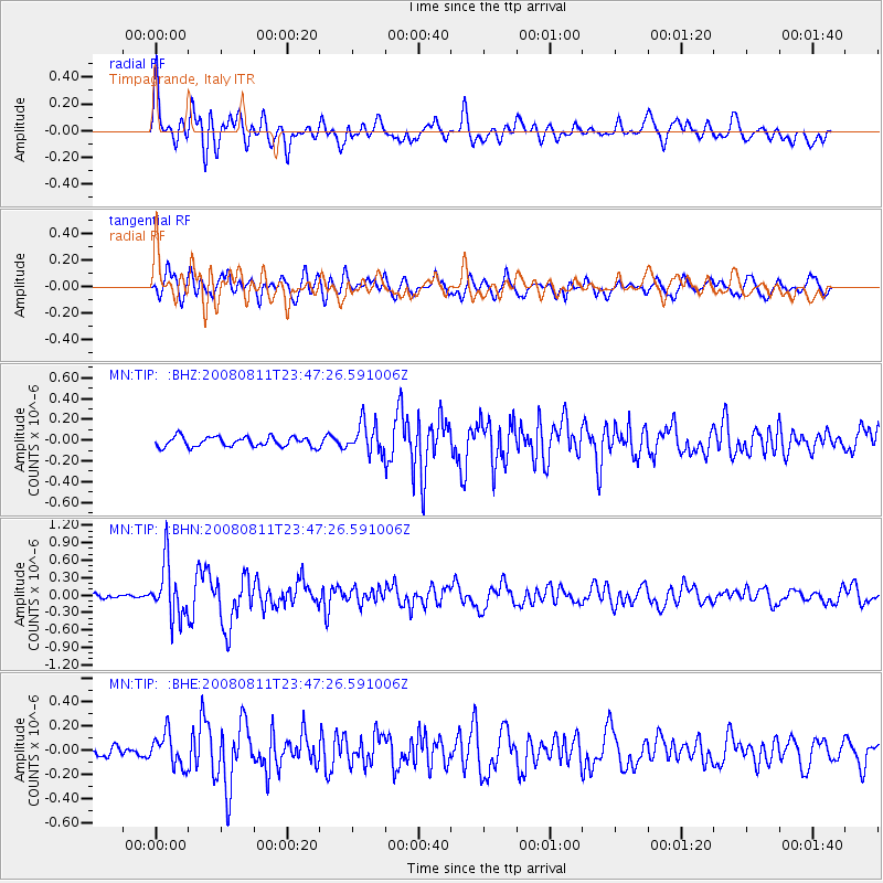
Earthquake location: Central Mid-Atlantic Ridge
Earthquake latitude/longitude: -1.0/-21.8
Earthquake time(UTC): 2008/08/11 (224) 23:38:38 GMT
Earthquake Depth: 13 km
Earthquake Magnitude: 6.0 MW, 5.2 MS, 5.4 MB, 6.0 MW
Earthquake Catalog/Contributor: WHDF/NEIC
Network: MN MEDNET Project
Station: TIP Timpagrande, Italy
Lat/Lon: 39.18 N/16.76 E
Elevation: 789 m
Distance: 53.4 deg
Az: 37.158 deg
Baz: 230.986 deg
Ray Param: 0.06611679
Estimated Moho Depth: 30.5 km
Estimated Crust Vp/Vs: 2.06
Assumed Crust Vp: 6.1 km/s
Estimated Crust Vs: 2.965 km/s
Estimated Crust Poisson's Ratio: 0.35
Radial Match: 83.47455 %
Radial Bump: 400
Transverse Match: 75.29709 %
Transverse Bump: 400
SOD ConfigId: 2504
Insert Time: 2010-03-08 17:22:12.417 +0000
GWidth: 2.5
Max Bumps: 400
Tol: 0.001

Signal To Noise

ChannelStoNSTALTA
MN:TIP: :BHN:20080811T23:47:26.591006Z13.6052334.634764E-73.4066037E-8
MN:TIP: :BHE:20080811T23:47:26.591006Z3.00225691.3540516E-74.5101125E-8
MN:TIP: :BHZ:20080811T23:47:26.591006Z3.02483921.4411285E-74.7643145E-8
Arrivals
Ps5.5 SECOND
PpPs15 SECOND
PsPs/PpSs20 SECOND