You are here: Home > Network List > G - GEOSCOPE Stations List
> Station INU Inuyama, Japan > Earthquake Result Viewer
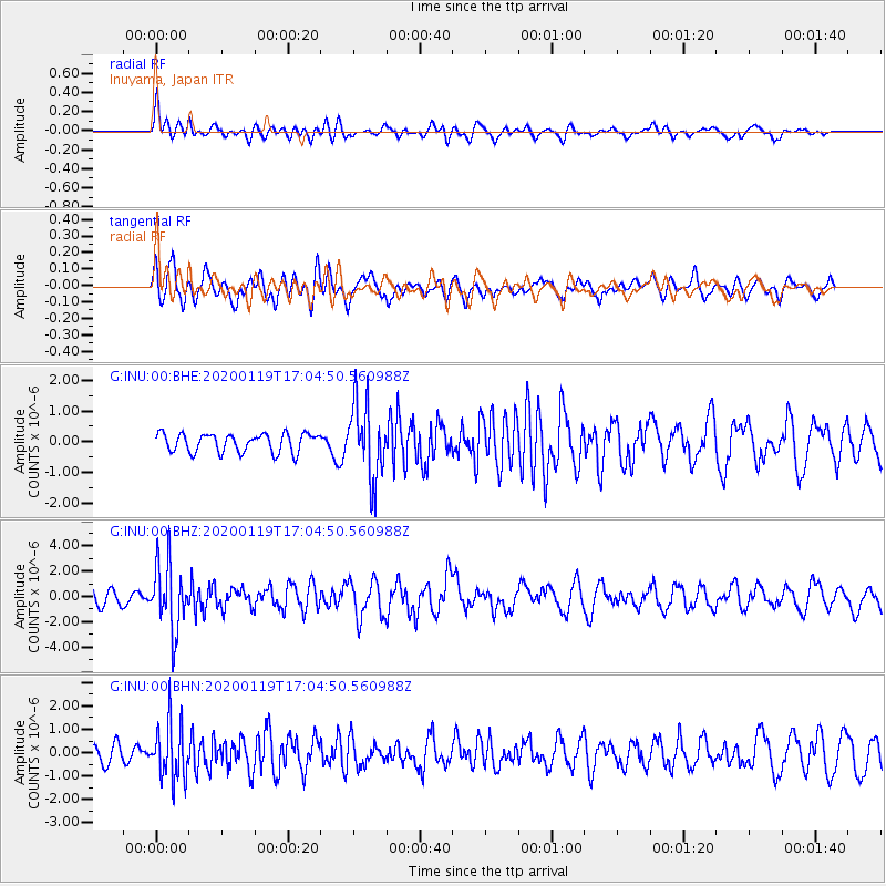
INU Inuyama, Japan - Earthquake Result Viewer
*The percent match for this event was below the threshold and hence no stack was calculated.
| Earthquake location: |
Minahassa Peninsula, Sulawesi |
| Earthquake latitude/longitude: |
-0.1/123.8 |
| Earthquake time(UTC): |
2020/01/19 (019) 16:58:19 GMT |
| Earthquake Depth: |
121 km |
| Earthquake Magnitude: |
6.1 Mww |
| Earthquake Catalog/Contributor: |
NEIC PDE/us |
|
| Network: |
G GEOSCOPE |
| Station: |
INU Inuyama, Japan |
| Lat/Lon: |
35.35 N/137.03 E |
| Elevation: |
132 m |
|
| Distance: |
37.4 deg |
| Az: |
17.964 deg |
| Baz: |
202.166 deg |
| Ray Param: |
$rayparam |
*The percent match for this event was below the threshold and hence was not used in the summary stack. |
|
| Radial Match: |
72.36963 % |
| Radial Bump: |
400 |
| Transverse Match: |
60.319054 % |
| Transverse Bump: |
400 |
| SOD ConfigId: |
20465011 |
| Insert Time: |
2020-02-02 17:01:28.773 +0000 |
| GWidth: |
2.5 |
| Max Bumps: |
400 |
| Tol: |
0.001 |
|
Signal To Noise
| Channel | StoN | STA | LTA |
| G:INU:00:BHZ:20200119T17:04:50.560988Z | 3.6467924 | 2.6436721E-6 | 7.2493077E-7 |
| G:INU:00:BHN:20200119T17:04:50.560988Z | 2.2304444 | 1.2089869E-6 | 5.4203855E-7 |
| G:INU:00:BHE:20200119T17:04:50.560988Z | 4.0791106 | 1.239712E-6 | 3.039172E-7 |
| Arrivals |
| Ps | |
| PpPs | |
| PsPs/PpSs | |


