
TIP Timpagrande, Italy - Earthquake Result Viewer

| ||||||||||||||||||
| ||||||||||||||||||
| ||||||||||||||||||
|
Signal To Noise
| Channel | StoN | STA | LTA |
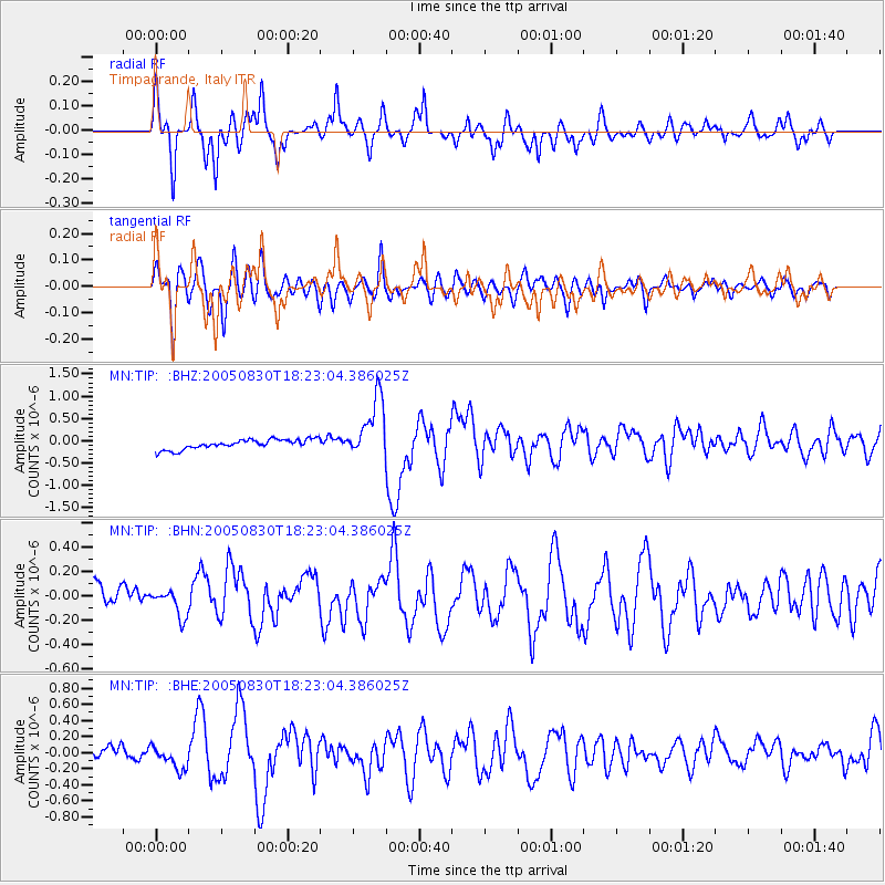
| MN:TIP: :BHN:20050830T18:23:04.386025Z | 0.68084216 | 1.00499804E-7 | 1.4761102E-7 |
| MN:TIP: :BHE:20050830T18:23:04.386025Z | 1.208437 | 1.285438E-7 | 1.0637195E-7 |
| MN:TIP: :BHZ:20050830T18:23:04.386025Z | 6.157711 | 6.744211E-7 | 1.0952464E-7 |
| Arrivals | |
| Ps | 5.9 SECOND |
| PpPs | 16 SECOND |
| PsPs/PpSs | 22 SECOND |

