TIP Timpagrande, Italy - Earthquake Result Viewer
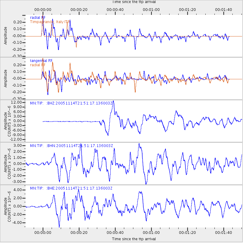
Earthquake location: Off East Coast Of Honshu, Japan
Earthquake latitude/longitude: 38.1/144.9
Earthquake time(UTC): 2005/11/14 (318) 21:38:51 GMT
Earthquake Depth: 11 km
Earthquake Magnitude: 6.7 MB, 6.8 MS, 7.0 MW, 6.9 MW
Earthquake Catalog/Contributor: WHDF/NEIC
Network: MN MEDNET Project
Station: TIP Timpagrande, Italy
Lat/Lon: 39.18 N/16.76 E
Elevation: 789 m
Distance: 89.5 deg
Az: 322.313 deg
Baz: 38.352 deg
Ray Param: 0.041774362
Estimated Moho Depth: 30.5 km
Estimated Crust Vp/Vs: 2.04
Assumed Crust Vp: 6.1 km/s
Estimated Crust Vs: 2.987 km/s
Estimated Crust Poisson's Ratio: 0.34
Radial Match: 92.90537 %
Radial Bump: 400
Transverse Match: 88.69956 %
Transverse Bump: 400
SOD ConfigId: 2448
Insert Time: 2010-03-08 17:22:27.580 +0000
GWidth: 2.5
Max Bumps: 400
Tol: 0.001

Signal To Noise

ChannelStoNSTALTA
MN:TIP: :BHN:20051114T21:51:17.136003Z1.9361372.3561853E-71.2169518E-7
MN:TIP: :BHE:20051114T21:51:17.136003Z2.79106643.1013437E-71.11116805E-7
MN:TIP: :BHZ:20051114T21:51:17.136003Z21.7417261.7246734E-67.932551E-8
Arrivals
Ps5.3 SECOND
PpPs15 SECOND
PsPs/PpSs20 SECOND