TIP Timpagrande, Italy - Earthquake Result Viewer
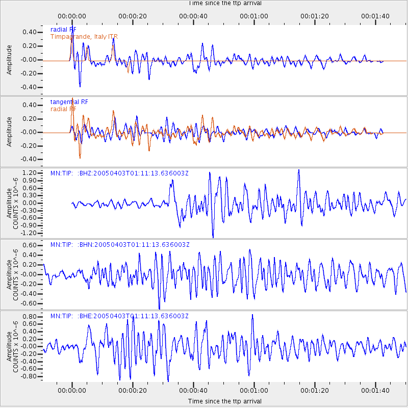
Earthquake location: Northern Sumatra, Indonesia
Earthquake latitude/longitude: 0.4/98.3
Earthquake time(UTC): 2005/04/03 (093) 00:59:21 GMT
Earthquake Depth: 30 km
Earthquake Magnitude: 5.9 MB, 5.9 MS, 6.0 MW, 6.0 MW
Earthquake Catalog/Contributor: WHDF/NEIC
Network: MN MEDNET Project
Station: TIP Timpagrande, Italy
Lat/Lon: 39.18 N/16.76 E
Elevation: 789 m
Distance: 83.2 deg
Az: 309.263 deg
Baz: 95.048 deg
Ray Param: 0.046306428
Estimated Moho Depth: 31.25 km
Estimated Crust Vp/Vs: 1.76
Assumed Crust Vp: 6.1 km/s
Estimated Crust Vs: 3.466 km/s
Estimated Crust Poisson's Ratio: 0.26
Radial Match: 83.776115 %
Radial Bump: 400
Transverse Match: 79.35341 %
Transverse Bump: 400
SOD ConfigId: 2459
Insert Time: 2010-03-08 17:22:37.693 +0000
GWidth: 2.5
Max Bumps: 400
Tol: 0.001

Signal To Noise

ChannelStoNSTALTA
MN:TIP: :BHN:20050403T01:11:13.636003Z0.796162076.890832E-88.655063E-8
MN:TIP: :BHE:20050403T01:11:13.636003Z2.04381061.8473146E-79.03858E-8
MN:TIP: :BHZ:20050403T01:11:13.636003Z5.0279444.131275E-78.216629E-8
Arrivals
Ps4.0 SECOND
PpPs14 SECOND
PsPs/PpSs18 SECOND