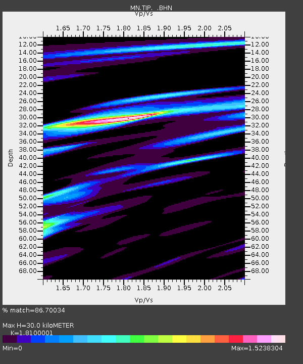
TIP Timpagrande, Italy - Earthquake Result Viewer
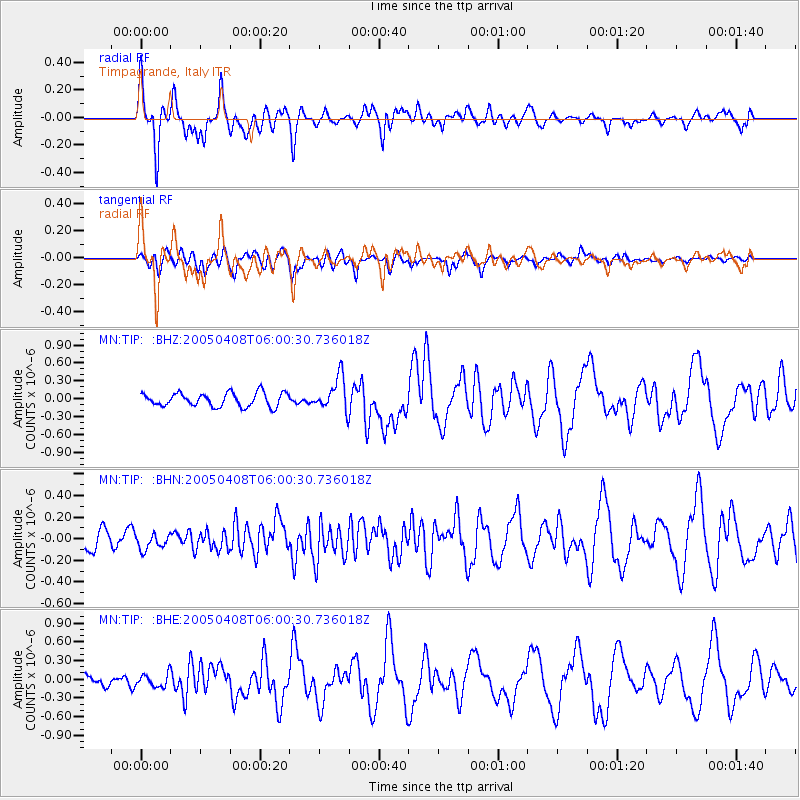
Earthquake location: Southwest Of Sumatra, Indonesia
Earthquake latitude/longitude: -0.2/97.7
Earthquake time(UTC): 2005/04/08 (098) 05:48:37 GMT
Earthquake Depth: 21 km
Earthquake Magnitude: 5.7 MB, 6.3 MS, 6.1 MW, 6.1 MW
Earthquake Catalog/Contributor: WHDF/NEIC
Network: MN MEDNET Project
Station: TIP Timpagrande, Italy
Lat/Lon: 39.18 N/16.76 E
Elevation: 789 m
Distance: 83.1 deg
Az: 309.361 deg
Baz: 95.875 deg
Ray Param: 0.046386674
Estimated Moho Depth: 30.0 km
Estimated Crust Vp/Vs: 1.81
Assumed Crust Vp: 6.1 km/s
Estimated Crust Vs: 3.37 km/s
Estimated Crust Poisson's Ratio: 0.28
Radial Match: 86.70034 %
Radial Bump: 400
Transverse Match: 75.8331 %
Transverse Bump: 400
SOD ConfigId: 2459
Insert Time: 2010-03-08 17:22:40.320 +0000
GWidth: 2.5
Max Bumps: 400
Tol: 0.001

Signal To Noise

ChannelStoNSTALTA
MN:TIP: :BHN:20050408T06:00:30.736018Z0.85318527.263771E-88.51371E-8
MN:TIP: :BHE:20050408T06:00:30.736018Z1.23546481.03629326E-78.387882E-8
MN:TIP: :BHZ:20050408T06:00:30.736018Z2.46912622.81669E-71.1407639E-7
Arrivals
Ps4.1 SECOND
PpPs14 SECOND
PsPs/PpSs18 SECOND