
TIP Timpagrande, Italy - Earthquake Result Viewer
| ||||||||||||||||||
| ||||||||||||||||||
| ||||||||||||||||||
|
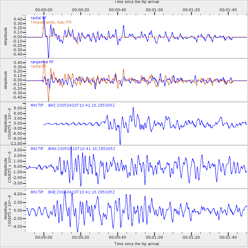
Signal To Noise
| Channel | StoN | STA | LTA |
| MN:TIP: :BHN:20050410T10:41:16.285005Z | 0.8103673 | 2.1793412E-7 | 2.6893252E-7 |
| MN:TIP: :BHE:20050410T10:41:16.285005Z | 1.5703436 | 8.5228805E-7 | 5.427398E-7 |
| MN:TIP: :BHZ:20050410T10:41:16.285005Z | 4.951977 | 1.9566648E-6 | 3.9512804E-7 |
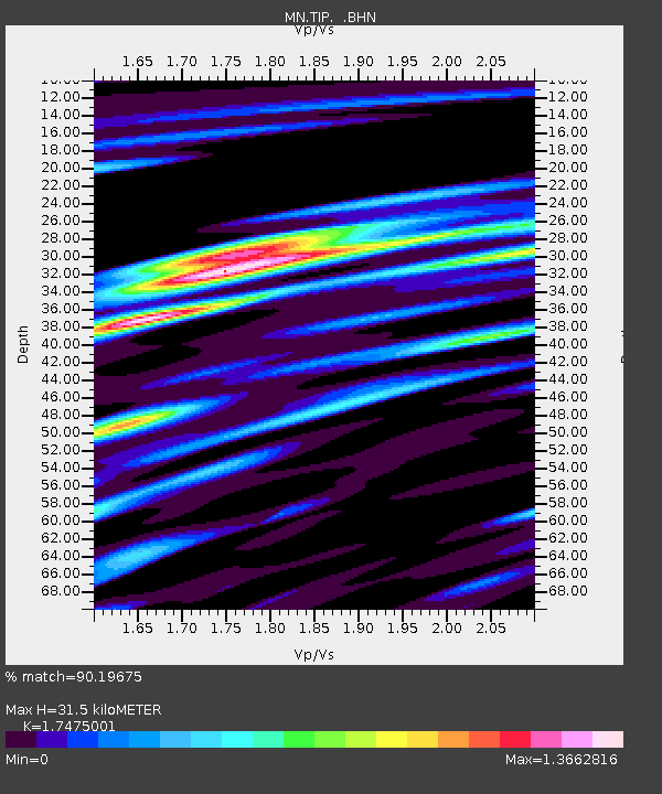
| Arrivals | |
| Ps | 3.9 SECOND |
| PpPs | 14 SECOND |
| PsPs/PpSs | 18 SECOND |

