TIP Timpagrande, Italy - Earthquake Result Viewer
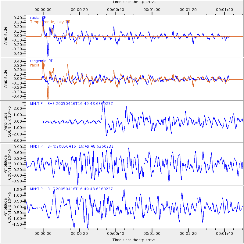
Earthquake location: Northern Sumatra, Indonesia
Earthquake latitude/longitude: 1.8/97.7
Earthquake time(UTC): 2005/04/16 (106) 16:38:03 GMT
Earthquake Depth: 31 km
Earthquake Magnitude: 6.0 MB, 6.2 MS, 6.4 MW, 6.3 MW
Earthquake Catalog/Contributor: WHDF/NEIC
Network: MN MEDNET Project
Station: TIP Timpagrande, Italy
Lat/Lon: 39.18 N/16.76 E
Elevation: 789 m
Distance: 81.8 deg
Az: 309.159 deg
Baz: 94.346 deg
Ray Param: 0.047289457
Estimated Moho Depth: 30.5 km
Estimated Crust Vp/Vs: 1.78
Assumed Crust Vp: 6.1 km/s
Estimated Crust Vs: 3.432 km/s
Estimated Crust Poisson's Ratio: 0.27
Radial Match: 88.703094 %
Radial Bump: 400
Transverse Match: 72.685875 %
Transverse Bump: 400
SOD ConfigId: 2459
Insert Time: 2010-03-08 17:22:43.328 +0000
GWidth: 2.5
Max Bumps: 400
Tol: 0.001

Signal To Noise

ChannelStoNSTALTA
MN:TIP: :BHN:20050416T16:49:48.636023Z1.16133951.9554994E-71.6838311E-7
MN:TIP: :BHE:20050416T16:49:48.636023Z2.35562684.5524257E-71.9325752E-7
MN:TIP: :BHZ:20050416T16:49:48.636023Z7.7989251.3538934E-61.736E-7
Arrivals
Ps4.0 SECOND
PpPs14 SECOND
PsPs/PpSs18 SECOND