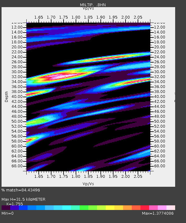
TIP Timpagrande, Italy - Earthquake Result Viewer
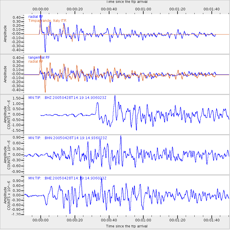
Earthquake location: Northern Sumatra, Indonesia
Earthquake latitude/longitude: 2.1/96.8
Earthquake time(UTC): 2005/04/28 (118) 14:07:33 GMT
Earthquake Depth: 22 km
Earthquake Magnitude: 5.9 MB, 6.2 MS, 6.3 MW, 6.2 MW
Earthquake Catalog/Contributor: WHDF/NEIC
Network: MN MEDNET Project
Station: TIP Timpagrande, Italy
Lat/Lon: 39.18 N/16.76 E
Elevation: 789 m
Distance: 80.9 deg
Az: 309.175 deg
Baz: 94.648 deg
Ray Param: 0.04791868
Estimated Moho Depth: 31.5 km
Estimated Crust Vp/Vs: 1.75
Assumed Crust Vp: 6.1 km/s
Estimated Crust Vs: 3.476 km/s
Estimated Crust Poisson's Ratio: 0.26
Radial Match: 84.43496 %
Radial Bump: 400
Transverse Match: 83.720146 %
Transverse Bump: 400
SOD ConfigId: 2459
Insert Time: 2010-03-08 17:22:44.498 +0000
GWidth: 2.5
Max Bumps: 400
Tol: 0.001

Signal To Noise

ChannelStoNSTALTA
MN:TIP: :BHN:20050428T14:19:14.936023Z1.03811165.1920377E-85.0014254E-8
MN:TIP: :BHE:20050428T14:19:14.936023Z4.977922.4415752E-74.9048097E-8
MN:TIP: :BHZ:20050428T14:19:14.936023Z8.4781155.1840277E-76.1146E-8
Arrivals
Ps4.0 SECOND
PpPs14 SECOND
PsPs/PpSs18 SECOND