
TIP Timpagrande, Italy - Earthquake Result Viewer
| ||||||||||||||||||
| ||||||||||||||||||
| ||||||||||||||||||
|
Signal To Noise
| Channel | StoN | STA | LTA |
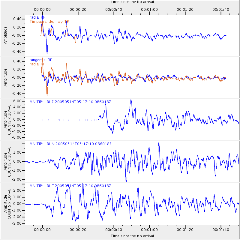
| MN:TIP: :BHN:20050514T05:17:10.086018Z | 2.080009 | 9.691487E-8 | 4.6593485E-8 |
| MN:TIP: :BHE:20050514T05:17:10.086018Z | 6.24022 | 3.486433E-7 | 5.587036E-8 |
| MN:TIP: :BHZ:20050514T05:17:10.086018Z | 29.405865 | 1.000021E-6 | 3.4007538E-8 |
| Arrivals | |
| Ps | 4.3 SECOND |
| PpPs | 13 SECOND |
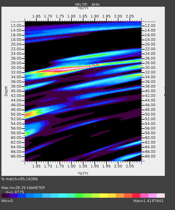
| PsPs/PpSs | 18 SECOND |

