TIP Timpagrande, Italy - Earthquake Result Viewer
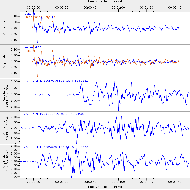
Earthquake location: Northern Sumatra, Indonesia
Earthquake latitude/longitude: 1.8/97.1
Earthquake time(UTC): 2005/07/05 (186) 01:52:02 GMT
Earthquake Depth: 21 km
Earthquake Magnitude: 6.2 MB, 6.8 MS, 6.7 MW, 6.6 MW
Earthquake Catalog/Contributor: WHDF/NEIC
Network: MN MEDNET Project
Station: TIP Timpagrande, Italy
Lat/Lon: 39.18 N/16.76 E
Elevation: 789 m
Distance: 81.3 deg
Az: 309.195 deg
Baz: 94.711 deg
Ray Param: 0.04762879
Estimated Moho Depth: 30.75 km
Estimated Crust Vp/Vs: 1.77
Assumed Crust Vp: 6.1 km/s
Estimated Crust Vs: 3.437 km/s
Estimated Crust Poisson's Ratio: 0.27
Radial Match: 94.408646 %
Radial Bump: 400
Transverse Match: 88.89672 %
Transverse Bump: 400
SOD ConfigId: 2475
Insert Time: 2010-03-08 17:22:47.131 +0000
GWidth: 2.5
Max Bumps: 400
Tol: 0.001

Signal To Noise

ChannelStoNSTALTA
MN:TIP: :BHN:20050705T02:03:46.535022Z3.03736261.6791573E-75.52834E-8
MN:TIP: :BHE:20050705T02:03:46.535022Z11.0536396.869162E-76.21439E-8
MN:TIP: :BHZ:20050705T02:03:46.535022Z22.6233621.6420847E-67.258359E-8
Arrivals
Ps4.0 SECOND
PpPs14 SECOND
PsPs/PpSs18 SECOND