You are here: Home > Network List > TA - USArray Transportable Network (new EarthScope stations) Stations List
> Station F24K Squaw Lake, AK, USA > Earthquake Result Viewer
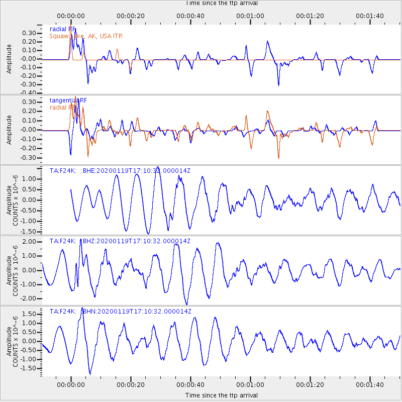
F24K Squaw Lake, AK, USA - Earthquake Result Viewer
*The percent match for this event was below the threshold and hence no stack was calculated.
| Earthquake location: |
Minahassa Peninsula, Sulawesi |
| Earthquake latitude/longitude: |
-0.1/123.8 |
| Earthquake time(UTC): |
2020/01/19 (019) 16:58:19 GMT |
| Earthquake Depth: |
121 km |
| Earthquake Magnitude: |
6.1 Mww |
| Earthquake Catalog/Contributor: |
NEIC PDE/us |
|
| Network: |
TA USArray Transportable Network (new EarthScope stations) |
| Station: |
F24K Squaw Lake, AK, USA |
| Lat/Lon: |
67.52 N/147.89 W |
| Elevation: |
736 m |
|
| Distance: |
89.5 deg |
| Az: |
22.608 deg |
| Baz: |
268.412 deg |
| Ray Param: |
$rayparam |
*The percent match for this event was below the threshold and hence was not used in the summary stack. |
|
| Radial Match: |
62.31459 % |
| Radial Bump: |
400 |
| Transverse Match: |
84.26501 % |
| Transverse Bump: |
371 |
| SOD ConfigId: |
20465011 |
| Insert Time: |
2020-02-02 17:05:25.854 +0000 |
| GWidth: |
2.5 |
| Max Bumps: |
400 |
| Tol: |
0.001 |
|
Signal To Noise
| Channel | StoN | STA | LTA |
| TA:F24K: :BHZ:20200119T17:10:32.000014Z | 1.2351267 | 1.1099798E-6 | 8.9867694E-7 |
| TA:F24K: :BHN:20200119T17:10:32.000014Z | 2.668654 | 1.067737E-6 | 4.0010318E-7 |
| TA:F24K: :BHE:20200119T17:10:32.000014Z | 1.3210692 | 9.5168474E-7 | 7.203898E-7 |
| Arrivals |
| Ps | |
| PpPs | |
| PsPs/PpSs | |


