You are here: Home > Network List > TA - USArray Transportable Network (new EarthScope stations) Stations List
> Station G31M Satah River, YT, CAN > Earthquake Result Viewer
G31M Satah River, YT, CAN - Earthquake Result Viewer
*The percent match for this event was below the threshold and hence no stack was calculated.
| Earthquake location: |
Minahassa Peninsula, Sulawesi |
| Earthquake latitude/longitude: |
-0.1/123.8 |
| Earthquake time(UTC): |
2020/01/19 (019) 16:58:19 GMT |
| Earthquake Depth: |
121 km |
| Earthquake Magnitude: |
6.1 Mww |
| Earthquake Catalog/Contributor: |
NEIC PDE/us |
|
| Network: |
TA USArray Transportable Network (new EarthScope stations) |
| Station: |
G31M Satah River, YT, CAN |
| Lat/Lon: |
66.92 N/134.27 W |
| Elevation: |
61 m |
|
| Distance: |
94.8 deg |
| Az: |
22.769 deg |
| Baz: |
280.957 deg |
| Ray Param: |
$rayparam |
*The percent match for this event was below the threshold and hence was not used in the summary stack. |
|
| Radial Match: |
49.331196 % |
| Radial Bump: |
400 |
| Transverse Match: |
55.06776 % |
| Transverse Bump: |
400 |
| SOD ConfigId: |
20465011 |
| Insert Time: |
2020-02-02 17:05:38.351 +0000 |
| GWidth: |
2.5 |
| Max Bumps: |
400 |
| Tol: |
0.001 |
|
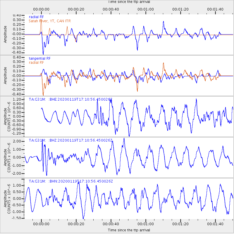
Signal To Noise
| Channel | StoN | STA | LTA |
| TA:G31M: :BHZ:20200119T17:10:56.450026Z | 3.0019228 | 1.1571257E-6 | 3.854615E-7 |
| TA:G31M: :BHN:20200119T17:10:56.450026Z | 0.6297642 | 3.7262893E-7 | 5.91696E-7 |
| TA:G31M: :BHE:20200119T17:10:56.450026Z | 1.4706585 | 4.775877E-7 | 3.2474412E-7 |
| Arrivals |
| Ps | |
| PpPs | |
| PsPs/PpSs | |


