You are here: Home > Network List > TA - USArray Transportable Network (new EarthScope stations) Stations List
> Station I17K Unalakleet, AK, USA > Earthquake Result Viewer
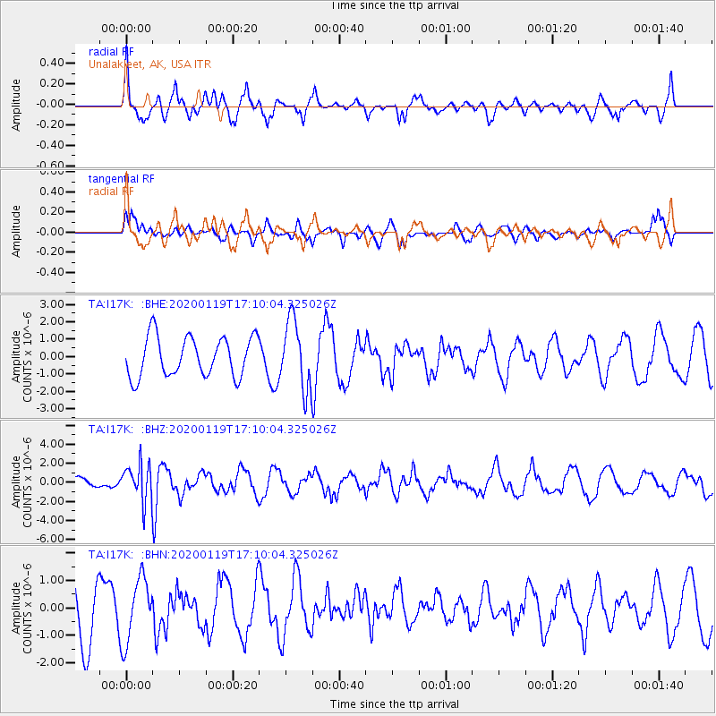
I17K Unalakleet, AK, USA - Earthquake Result Viewer
*The percent match for this event was below the threshold and hence no stack was calculated.
| Earthquake location: |
Minahassa Peninsula, Sulawesi |
| Earthquake latitude/longitude: |
-0.1/123.8 |
| Earthquake time(UTC): |
2020/01/19 (019) 16:58:19 GMT |
| Earthquake Depth: |
121 km |
| Earthquake Magnitude: |
6.1 Mww |
| Earthquake Catalog/Contributor: |
NEIC PDE/us |
|
| Network: |
TA USArray Transportable Network (new EarthScope stations) |
| Station: |
I17K Unalakleet, AK, USA |
| Lat/Lon: |
63.89 N/160.70 W |
| Elevation: |
105 m |
|
| Distance: |
83.7 deg |
| Az: |
25.534 deg |
| Baz: |
256.912 deg |
| Ray Param: |
$rayparam |
*The percent match for this event was below the threshold and hence was not used in the summary stack. |
|
| Radial Match: |
64.20877 % |
| Radial Bump: |
371 |
| Transverse Match: |
45.47952 % |
| Transverse Bump: |
339 |
| SOD ConfigId: |
20465011 |
| Insert Time: |
2020-02-02 17:05:49.121 +0000 |
| GWidth: |
2.5 |
| Max Bumps: |
400 |
| Tol: |
0.001 |
|
Signal To Noise
| Channel | StoN | STA | LTA |
| TA:I17K: :BHZ:20200119T17:10:04.325026Z | 2.8642223 | 1.965402E-6 | 6.861904E-7 |
| TA:I17K: :BHN:20200119T17:10:04.325026Z | 0.7391283 | 1.1617568E-6 | 1.5717932E-6 |
| TA:I17K: :BHE:20200119T17:10:04.325026Z | 1.7423664 | 1.9889635E-6 | 1.1415299E-6 |
| Arrivals |
| Ps | |
| PpPs | |
| PsPs/PpSs | |


