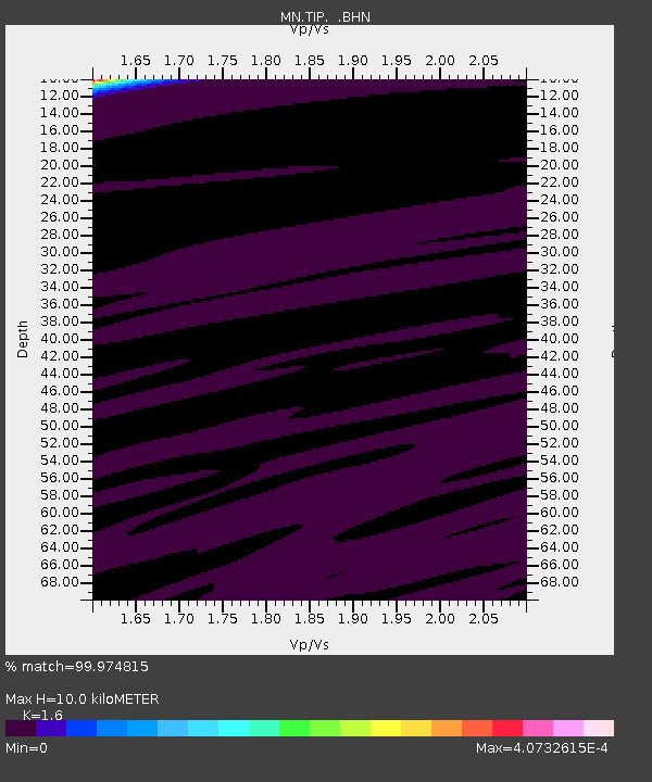
TIP Timpagrande, Italy - Earthquake Result Viewer
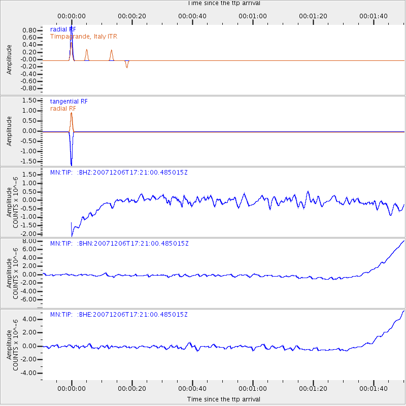
Earthquake location: Northern Mid-Atlantic Ridge
Earthquake latitude/longitude: 22.7/-45.1
Earthquake time(UTC): 2007/12/06 (340) 17:12:03 GMT
Earthquake Depth: 10 km
Earthquake Magnitude: 5.5 MB, 5.4 MS, 5.8 MW, 5.7 MW
Earthquake Catalog/Contributor: WHDF/NEIC
Network: MN MEDNET Project
Station: TIP Timpagrande, Italy
Lat/Lon: 39.18 N/16.76 E
Elevation: 789 m
Distance: 54.6 deg
Az: 57.272 deg
Baz: 271.701 deg
Ray Param: 0.06536746
Estimated Moho Depth: 10.0 km
Estimated Crust Vp/Vs: 1.60
Assumed Crust Vp: 6.1 km/s
Estimated Crust Vs: 3.812 km/s
Estimated Crust Poisson's Ratio: 0.18
Radial Match: 99.974815 %
Radial Bump: 2
Transverse Match: 99.98603 %
Transverse Bump: 2
SOD ConfigId: 2564
Insert Time: 2010-03-08 17:23:00.169 +0000
GWidth: 2.5
Max Bumps: 400
Tol: 0.001

Signal To Noise

ChannelStoNSTALTA
MN:TIP: :BHN:20071206T17:21:00.485015Z0.92319766.485178E-77.024691E-7
MN:TIP: :BHE:20071206T17:21:00.485015Z0.931323234.1571312E-74.4636826E-7
MN:TIP: :BHZ:20071206T17:21:00.485015Z0.98745425.93853E-76.0139797E-7
Arrivals
Ps1.0 SECOND
PpPs4.0 SECOND
PsPs/PpSs5.1 SECOND