You are here: Home > Network List > IW - Intermountain West Stations List
> Station DLMT Dillon, Montana, USA > Earthquake Result Viewer
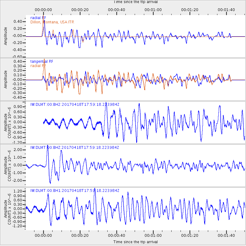
DLMT Dillon, Montana, USA - Earthquake Result Viewer
*The percent match for this event was below the threshold and hence no stack was calculated.
| Earthquake location: |
Peru-Ecuador Border Region |
| Earthquake latitude/longitude: |
-2.7/-75.3 |
| Earthquake time(UTC): |
2017/04/18 (108) 17:49:55 GMT |
| Earthquake Depth: |
11 km |
| Earthquake Magnitude: |
6.0 Mww |
| Earthquake Catalog/Contributor: |
NEIC PDE/us |
|
| Network: |
IW Intermountain West |
| Station: |
DLMT Dillon, Montana, USA |
| Lat/Lon: |
45.36 N/112.60 W |
| Elevation: |
1569 m |
|
| Distance: |
58.2 deg |
| Az: |
329.834 deg |
| Baz: |
134.605 deg |
| Ray Param: |
$rayparam |
*The percent match for this event was below the threshold and hence was not used in the summary stack. |
|
| Radial Match: |
75.43253 % |
| Radial Bump: |
400 |
| Transverse Match: |
67.53595 % |
| Transverse Bump: |
400 |
| SOD ConfigId: |
2028011 |
| Insert Time: |
2017-05-02 17:55:12.485 +0000 |
| GWidth: |
2.5 |
| Max Bumps: |
400 |
| Tol: |
0.001 |
|
Signal To Noise
| Channel | StoN | STA | LTA |
| IW:DLMT:00:BHZ:20170418T17:59:18.223984Z | 9.398749 | 1.2740792E-6 | 1.3555838E-7 |
| IW:DLMT:00:BH1:20170418T17:59:18.223984Z | 4.9317627 | 5.797383E-7 | 1.1755195E-7 |
| IW:DLMT:00:BH2:20170418T17:59:18.223984Z | 3.403657 | 5.265946E-7 | 1.5471436E-7 |
| Arrivals |
| Ps | |
| PpPs | |
| PsPs/PpSs | |


