TIP Timpagrande, Italy - Earthquake Result Viewer
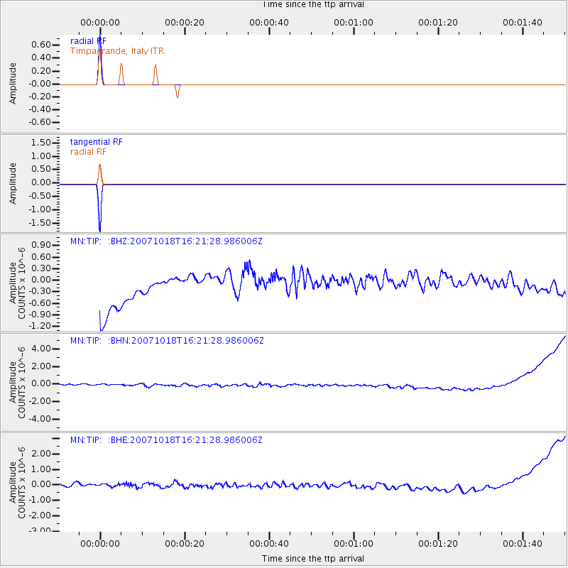
Earthquake location: Northern Mid-Atlantic Ridge
Earthquake latitude/longitude: 30.1/-42.6
Earthquake time(UTC): 2007/10/18 (291) 16:13:14 GMT
Earthquake Depth: 10 km
Earthquake Magnitude: 5.5 MB, 5.3 MS, 5.7 MW, 5.7 MW
Earthquake Catalog/Contributor: WHDF/NEIC
Network: MN MEDNET Project
Station: TIP Timpagrande, Italy
Lat/Lon: 39.18 N/16.76 E
Elevation: 789 m
Distance: 48.9 deg
Az: 62.56 deg
Baz: 278.422 deg
Ray Param: 0.06906029
Estimated Moho Depth: 10.0 km
Estimated Crust Vp/Vs: 1.60
Assumed Crust Vp: 6.1 km/s
Estimated Crust Vs: 3.812 km/s
Estimated Crust Poisson's Ratio: 0.18
Radial Match: 99.96625 %
Radial Bump: 4
Transverse Match: 99.98592 %
Transverse Bump: 3
SOD ConfigId: 2564
Insert Time: 2010-03-08 17:23:04.917 +0000
GWidth: 2.5
Max Bumps: 400
Tol: 0.001

Signal To Noise

ChannelStoNSTALTA
MN:TIP: :BHN:20071018T16:21:28.986006Z0.951905674.4972953E-74.7245177E-7
MN:TIP: :BHE:20071018T16:21:28.986006Z0.83546792.4115494E-72.8864656E-7
MN:TIP: :BHZ:20071018T16:21:28.986006Z1.11780764.234967E-73.7886363E-7
Arrivals
Ps1.0 SECOND
PpPs4.0 SECOND
PsPs/PpSs5.1 SECOND