You are here: Home > Network List > MN - MEDNET Project Stations List
> Station TIP Timpagrande, Italy > Earthquake Result Viewer
TIP Timpagrande, Italy - Earthquake Result Viewer
| Earthquake location: |
Ascension Island Region |
| Earthquake latitude/longitude: |
-7.1/-11.7 |
| Earthquake time(UTC): |
2007/09/26 (269) 18:39:34 GMT |
| Earthquake Depth: |
10 km |
| Earthquake Magnitude: |
5.6 MW, 5.3 MS, 5.2 MB |
| Earthquake Catalog/Contributor: |
WHDF/NEIC |
|
| Network: |
MN MEDNET Project |
| Station: |
TIP Timpagrande, Italy |
| Lat/Lon: |
39.18 N/16.76 E |
| Elevation: |
789 m |
|
| Distance: |
53.0 deg |
| Az: |
27.623 deg |
| Baz: |
216.303 deg |
| Ray Param: |
0.06636092 |
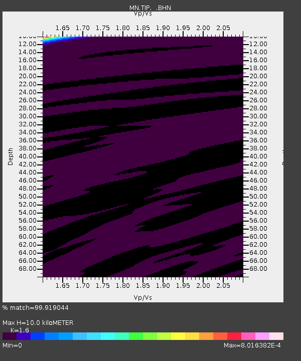
| Estimated Moho Depth: |
10.0 km |
| Estimated Crust Vp/Vs: |
1.60 |
| Assumed Crust Vp: |
6.1 km/s |
| Estimated Crust Vs: |
3.812 km/s |
| Estimated Crust Poisson's Ratio: |
0.18 |
|
| Radial Match: |
99.919044 % |
| Radial Bump: |
9 |
| Transverse Match: |
95.016655 % |
| Transverse Bump: |
61 |
| SOD ConfigId: |
2564 |
| Insert Time: |
2010-03-08 17:23:06.066 +0000 |
| GWidth: |
2.5 |
| Max Bumps: |
400 |
| Tol: |
0.001 |
|
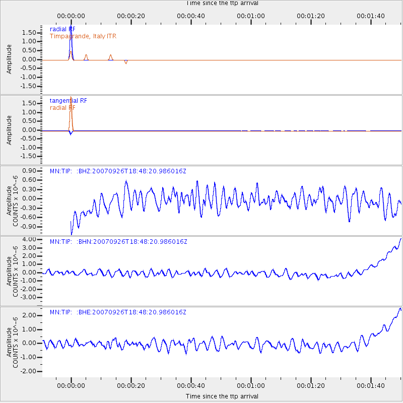
Signal To Noise
| Channel | StoN | STA | LTA |
| MN:TIP: :BHN:20070926T18:48:20.986016Z | 1.0539653 | 3.7998748E-7 | 3.6053126E-7 |
| MN:TIP: :BHE:20070926T18:48:20.986016Z | 0.9055812 | 2.2242789E-7 | 2.4561893E-7 |
| MN:TIP: :BHZ:20070926T18:48:20.986016Z | 0.92191976 | 3.1983694E-7 | 3.469249E-7 |
| Arrivals |
| Ps | 1.0 SECOND |
| PpPs | 4.0 SECOND |
| PsPs/PpSs | 5.1 SECOND |


