You are here: Home > Network List > MN - MEDNET Project Stations List
> Station TIP Timpagrande, Italy > Earthquake Result Viewer
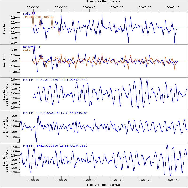
TIP Timpagrande, Italy - Earthquake Result Viewer
*The percent match for this event was below the threshold and hence no stack was calculated.
| Earthquake location: |
Northwest Of Ryukyu Islands |
| Earthquake latitude/longitude: |
27.4/126.7 |
| Earthquake time(UTC): |
2009/03/26 (085) 19:19:59 GMT |
| Earthquake Depth: |
160 km |
| Earthquake Magnitude: |
5.6 MB, 5.9 MW, 5.9 MW |
| Earthquake Catalog/Contributor: |
WHDF/NEIC |
|
| Network: |
MN MEDNET Project |
| Station: |
TIP Timpagrande, Italy |
| Lat/Lon: |
39.18 N/16.76 E |
| Elevation: |
789 m |
|
| Distance: |
87.0 deg |
| Az: |
312.976 deg |
| Baz: |
56.803 deg |
| Ray Param: |
$rayparam |
*The percent match for this event was below the threshold and hence was not used in the summary stack. |
|
| Radial Match: |
54.262466 % |
| Radial Bump: |
335 |
| Transverse Match: |
63.71936 % |
| Transverse Bump: |
400 |
| SOD ConfigId: |
2658 |
| Insert Time: |
2010-03-08 17:23:36.402 +0000 |
| GWidth: |
2.5 |
| Max Bumps: |
400 |
| Tol: |
0.001 |
|
Signal To Noise
| Channel | StoN | STA | LTA |
| MN:TIP: :BHN:20090326T19:31:55.564028Z | 1.8234818 | 6.367109E-7 | 3.4917318E-7 |
| MN:TIP: :BHE:20090326T19:31:55.564028Z | 1.3323834 | 4.6255715E-7 | 3.471652E-7 |
| MN:TIP: :BHZ:20090326T19:31:55.564028Z | 1.236952 | 4.137949E-7 | 3.3452787E-7 |
| Arrivals |
| Ps | |
| PpPs | |
| PsPs/PpSs | |


