You are here: Home > Network List > MN - MEDNET Project Stations List
> Station TIP Timpagrande, Italy > Earthquake Result Viewer
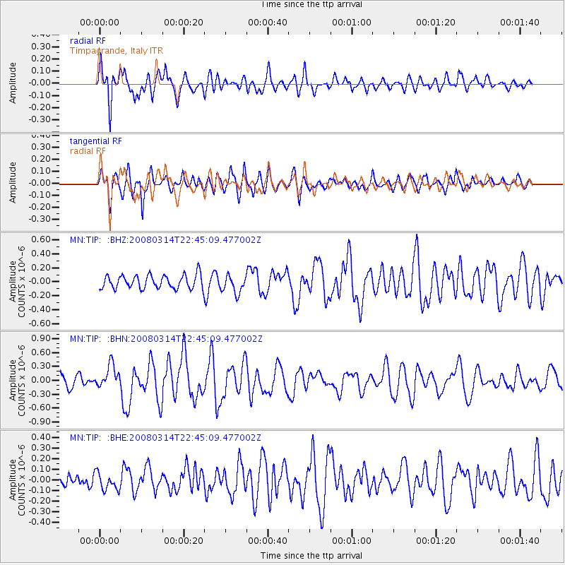
TIP Timpagrande, Italy - Earthquake Result Viewer
*The percent match for this event was below the threshold and hence no stack was calculated.
| Earthquake location: |
Bonin Islands, Japan Region |
| Earthquake latitude/longitude: |
27.0/142.6 |
| Earthquake time(UTC): |
2008/03/14 (074) 22:32:09 GMT |
| Earthquake Depth: |
11 km |
| Earthquake Magnitude: |
5.7 MB, 5.9 MS, 6.0 MW, 6.0 MW |
| Earthquake Catalog/Contributor: |
WHDF/NEIC |
|
| Network: |
MN MEDNET Project |
| Station: |
TIP Timpagrande, Italy |
| Lat/Lon: |
39.18 N/16.76 E |
| Elevation: |
789 m |
|
| Distance: |
97.0 deg |
| Az: |
320.593 deg |
| Baz: |
46.789 deg |
| Ray Param: |
$rayparam |
*The percent match for this event was below the threshold and hence was not used in the summary stack. |
|
| Radial Match: |
85.02979 % |
| Radial Bump: |
400 |
| Transverse Match: |
76.6685 % |
| Transverse Bump: |
400 |
| SOD ConfigId: |
2504 |
| Insert Time: |
2010-03-08 17:23:40.781 +0000 |
| GWidth: |
2.5 |
| Max Bumps: |
400 |
| Tol: |
0.001 |
|
Signal To Noise
| Channel | StoN | STA | LTA |
| MN:TIP: :BHN:20080314T22:45:09.477002Z | 2.7907567 | 2.5605578E-7 | 9.175138E-8 |
| MN:TIP: :BHE:20080314T22:45:09.477002Z | 1.4893055 | 7.965413E-8 | 5.348408E-8 |
| MN:TIP: :BHZ:20080314T22:45:09.477002Z | 1.3619903 | 1.3151704E-7 | 9.656239E-8 |
| Arrivals |
| Ps | |
| PpPs | |
| PsPs/PpSs | |


