You are here: Home > Network List > MN - MEDNET Project Stations List
> Station TIP Timpagrande, Italy > Earthquake Result Viewer
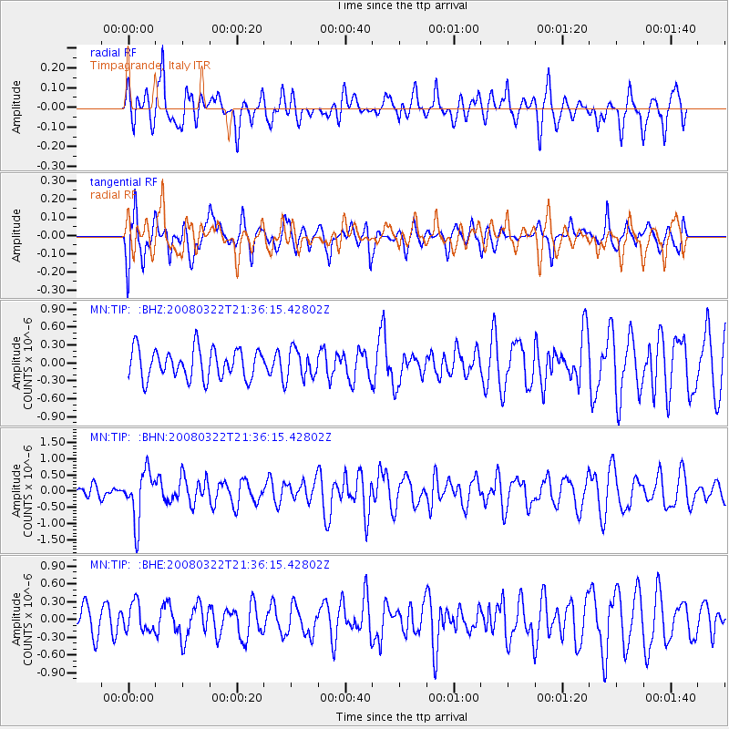
TIP Timpagrande, Italy - Earthquake Result Viewer
*The percent match for this event was below the threshold and hence no stack was calculated.
| Earthquake location: |
Andreanof Islands, Aleutian Is. |
| Earthquake latitude/longitude: |
52.2/-178.7 |
| Earthquake time(UTC): |
2008/03/22 (082) 21:24:11 GMT |
| Earthquake Depth: |
132 km |
| Earthquake Magnitude: |
5.8 MB, 6.2 MW, 6.1 MW |
| Earthquake Catalog/Contributor: |
WHDF/NEIC |
|
| Network: |
MN MEDNET Project |
| Station: |
TIP Timpagrande, Italy |
| Lat/Lon: |
39.18 N/16.76 E |
| Elevation: |
789 m |
|
| Distance: |
88.0 deg |
| Az: |
348.024 deg |
| Baz: |
9.462 deg |
| Ray Param: |
$rayparam |
*The percent match for this event was below the threshold and hence was not used in the summary stack. |
|
| Radial Match: |
81.45821 % |
| Radial Bump: |
400 |
| Transverse Match: |
64.91957 % |
| Transverse Bump: |
400 |
| SOD ConfigId: |
2504 |
| Insert Time: |
2010-03-08 17:23:42.068 +0000 |
| GWidth: |
2.5 |
| Max Bumps: |
400 |
| Tol: |
0.001 |
|
Signal To Noise
| Channel | StoN | STA | LTA |
| MN:TIP: :BHN:20080322T21:36:15.42802Z | 3.6349738 | 7.7912165E-7 | 2.1434037E-7 |
| MN:TIP: :BHE:20080322T21:36:15.42802Z | 0.66703933 | 2.3807301E-7 | 3.5691E-7 |
| MN:TIP: :BHZ:20080322T21:36:15.42802Z | 0.96335053 | 2.385642E-7 | 2.476401E-7 |
| Arrivals |
| Ps | |
| PpPs | |
| PsPs/PpSs | |


