You are here: Home > Network List > MN - MEDNET Project Stations List
> Station TIP Timpagrande, Italy > Earthquake Result Viewer
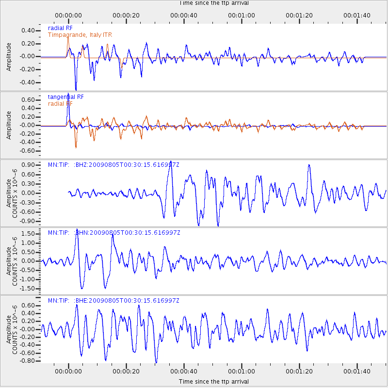
TIP Timpagrande, Italy - Earthquake Result Viewer
*The percent match for this event was below the threshold and hence no stack was calculated.
| Earthquake location: |
Southwestern Ryukyu Isl., Japan |
| Earthquake latitude/longitude: |
24.2/125.1 |
| Earthquake time(UTC): |
2009/08/05 (217) 00:17:58 GMT |
| Earthquake Depth: |
25 km |
| Earthquake Magnitude: |
5.9 MB, 5.9 MS, 6.2 MW, 6.1 MW |
| Earthquake Catalog/Contributor: |
WHDF/NEIC |
|
| Network: |
MN MEDNET Project |
| Station: |
TIP Timpagrande, Italy |
| Lat/Lon: |
39.18 N/16.76 E |
| Elevation: |
789 m |
|
| Distance: |
88.1 deg |
| Az: |
312.422 deg |
| Baz: |
60.117 deg |
| Ray Param: |
$rayparam |
*The percent match for this event was below the threshold and hence was not used in the summary stack. |
|
| Radial Match: |
90.03502 % |
| Radial Bump: |
400 |
| Transverse Match: |
98.40654 % |
| Transverse Bump: |
199 |
| SOD ConfigId: |
2622 |
| Insert Time: |
2010-03-08 17:24:07.148 +0000 |
| GWidth: |
2.5 |
| Max Bumps: |
400 |
| Tol: |
0.001 |
|
Signal To Noise
| Channel | StoN | STA | LTA |
| MN:TIP: :BHN:20090805T00:30:15.616997Z | 7.0620403 | 8.803243E-7 | 1.2465581E-7 |
| MN:TIP: :BHE:20090805T00:30:15.616997Z | 3.1583178 | 3.4820437E-7 | 1.1024995E-7 |
| MN:TIP: :BHZ:20090805T00:30:15.616997Z | 5.2549505 | 3.6637863E-7 | 6.972066E-8 |
| Arrivals |
| Ps | |
| PpPs | |
| PsPs/PpSs | |


