You are here: Home > Network List > MN - MEDNET Project Stations List
> Station TIP Timpagrande, Italy > Earthquake Result Viewer
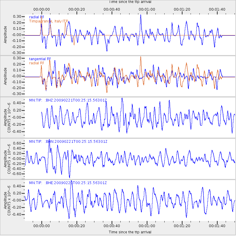
TIP Timpagrande, Italy - Earthquake Result Viewer
*The percent match for this event was below the threshold and hence no stack was calculated.
| Earthquake location: |
Ryukyu Islands, Japan |
| Earthquake latitude/longitude: |
28.9/130.9 |
| Earthquake time(UTC): |
2009/02/21 (052) 00:12:56 GMT |
| Earthquake Depth: |
24 km |
| Earthquake Magnitude: |
5.6 MB, 5.0 MS, 5.5 MW, 5.5 MW |
| Earthquake Catalog/Contributor: |
WHDF/NEIC |
|
| Network: |
MN MEDNET Project |
| Station: |
TIP Timpagrande, Italy |
| Lat/Lon: |
39.18 N/16.76 E |
| Elevation: |
789 m |
|
| Distance: |
88.6 deg |
| Az: |
314.792 deg |
| Baz: |
53.205 deg |
| Ray Param: |
$rayparam |
*The percent match for this event was below the threshold and hence was not used in the summary stack. |
|
| Radial Match: |
58.26273 % |
| Radial Bump: |
400 |
| Transverse Match: |
55.12924 % |
| Transverse Bump: |
400 |
| SOD ConfigId: |
2658 |
| Insert Time: |
2010-03-08 17:24:09.572 +0000 |
| GWidth: |
2.5 |
| Max Bumps: |
400 |
| Tol: |
0.001 |
|
Signal To Noise
| Channel | StoN | STA | LTA |
| MN:TIP: :BHN:20090221T00:25:15.56301Z | 1.8975083 | 3.1657203E-7 | 1.6683563E-7 |
| MN:TIP: :BHE:20090221T00:25:15.56301Z | 0.8907281 | 1.0780558E-7 | 1.2103085E-7 |
| MN:TIP: :BHZ:20090221T00:25:15.56301Z | 1.0975614 | 1.863887E-7 | 1.6982075E-7 |
| Arrivals |
| Ps | |
| PpPs | |
| PsPs/PpSs | |


