You are here: Home > Network List > MN - MEDNET Project Stations List
> Station TIP Timpagrande, Italy > Earthquake Result Viewer
TIP Timpagrande, Italy - Earthquake Result Viewer
*The percent match for this event was below the threshold and hence no stack was calculated.
| Earthquake location: |
Kuril Islands |
| Earthquake latitude/longitude: |
46.2/151.7 |
| Earthquake time(UTC): |
2009/04/17 (107) 14:51:58 GMT |
| Earthquake Depth: |
49 km |
| Earthquake Magnitude: |
5.5 MB, 5.0 MS, 5.7 MW, 5.6 MW |
| Earthquake Catalog/Contributor: |
WHDF/NEIC |
|
| Network: |
MN MEDNET Project |
| Station: |
TIP Timpagrande, Italy |
| Lat/Lon: |
39.18 N/16.76 E |
| Elevation: |
789 m |
|
| Distance: |
85.9 deg |
| Az: |
326.53 deg |
| Baz: |
29.546 deg |
| Ray Param: |
$rayparam |
*The percent match for this event was below the threshold and hence was not used in the summary stack. |
|
| Radial Match: |
70.65945 % |
| Radial Bump: |
400 |
| Transverse Match: |
61.97547 % |
| Transverse Bump: |
400 |
| SOD ConfigId: |
2658 |
| Insert Time: |
2010-03-08 17:24:10.074 +0000 |
| GWidth: |
2.5 |
| Max Bumps: |
400 |
| Tol: |
0.001 |
|
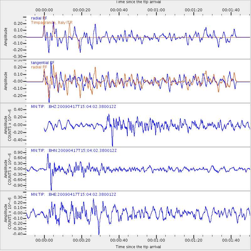
Signal To Noise
| Channel | StoN | STA | LTA |
| MN:TIP: :BHN:20090417T15:04:02.380012Z | 7.0985723 | 4.3326193E-7 | 6.103508E-8 |
| MN:TIP: :BHE:20090417T15:04:02.380012Z | 1.6109679 | 8.919031E-8 | 5.5364428E-8 |
| MN:TIP: :BHZ:20090417T15:04:02.380012Z | 1.7533026 | 1.200701E-7 | 6.8482244E-8 |
| Arrivals |
| Ps | |
| PpPs | |
| PsPs/PpSs | |


