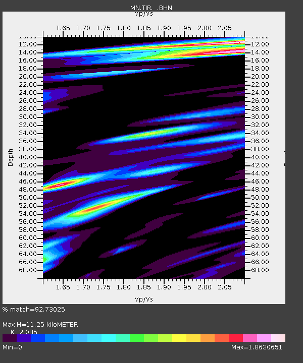
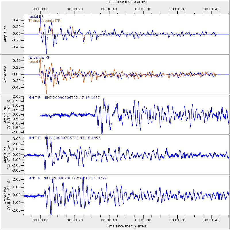
TIR Tirana, Albania - Earthquake Result Viewer

Earthquake location: Southeast Of Ryukyu Islands
Earthquake latitude/longitude: 24.9/128.0
Earthquake time(UTC): 2009/07/06 (187) 22:35:05 GMT
Earthquake Depth: 10 km
Earthquake Magnitude: 6.1 MB, 5.3 MS, 5.7 MW, 5.7 MW
Earthquake Catalog/Contributor: WHDF/NEIC
Network: MN MEDNET Project
Station: TIR Tirana, Albania
Lat/Lon: 41.35 N/19.86 E
Elevation: 247 m
Distance: 86.4 deg
Az: 314.211 deg
Baz: 59.85 deg
Ray Param: 0.044050954
Estimated Moho Depth: 11.25 km
Estimated Crust Vp/Vs: 2.09
Assumed Crust Vp: 5.967 km/s
Estimated Crust Vs: 2.862 km/s
Estimated Crust Poisson's Ratio: 0.35
Radial Match: 92.73025 %
Radial Bump: 400
Transverse Match: 85.43631 %
Transverse Bump: 400
SOD ConfigId: 2648
Insert Time: 2010-03-08 17:24:15.140 +0000
GWidth: 2.5
Max Bumps: 400
Tol: 0.001

Signal To Noise

ChannelStoNSTALTA
MN:TIR: :BHN:20090706T22:47:16.145Z13.8037511.4386601E-61.042224E-7
MN:TIR: :BHE:20090706T22:47:16.175029Z4.45909835.7936853E-71.2992952E-7
MN:TIR: :BHZ:20090706T22:47:16.145Z5.1510495.394987E-71.0473569E-7
Arrivals
Ps2.1 SECOND
PpPs5.7 SECOND
PsPs/PpSs7.8 SECOND