You are here: Home > Network List > US - United States National Seismic Network Stations List
> Station AMTX Amarillo, Texas, USA > Earthquake Result Viewer
AMTX Amarillo, Texas, USA - Earthquake Result Viewer
*The percent match for this event was below the threshold and hence no stack was calculated.
| Earthquake location: |
Peru-Ecuador Border Region |
| Earthquake latitude/longitude: |
-2.7/-75.3 |
| Earthquake time(UTC): |
2017/04/18 (108) 17:49:55 GMT |
| Earthquake Depth: |
11 km |
| Earthquake Magnitude: |
6.0 Mww |
| Earthquake Catalog/Contributor: |
NEIC PDE/us |
|
| Network: |
US United States National Seismic Network |
| Station: |
AMTX Amarillo, Texas, USA |
| Lat/Lon: |
34.53 N/101.41 W |
| Elevation: |
1010 m |
|
| Distance: |
44.4 deg |
| Az: |
328.751 deg |
| Baz: |
141.124 deg |
| Ray Param: |
$rayparam |
*The percent match for this event was below the threshold and hence was not used in the summary stack. |
|
| Radial Match: |
72.62397 % |
| Radial Bump: |
400 |
| Transverse Match: |
63.376522 % |
| Transverse Bump: |
400 |
| SOD ConfigId: |
2028011 |
| Insert Time: |
2017-05-02 17:56:45.867 +0000 |
| GWidth: |
2.5 |
| Max Bumps: |
400 |
| Tol: |
0.001 |
|
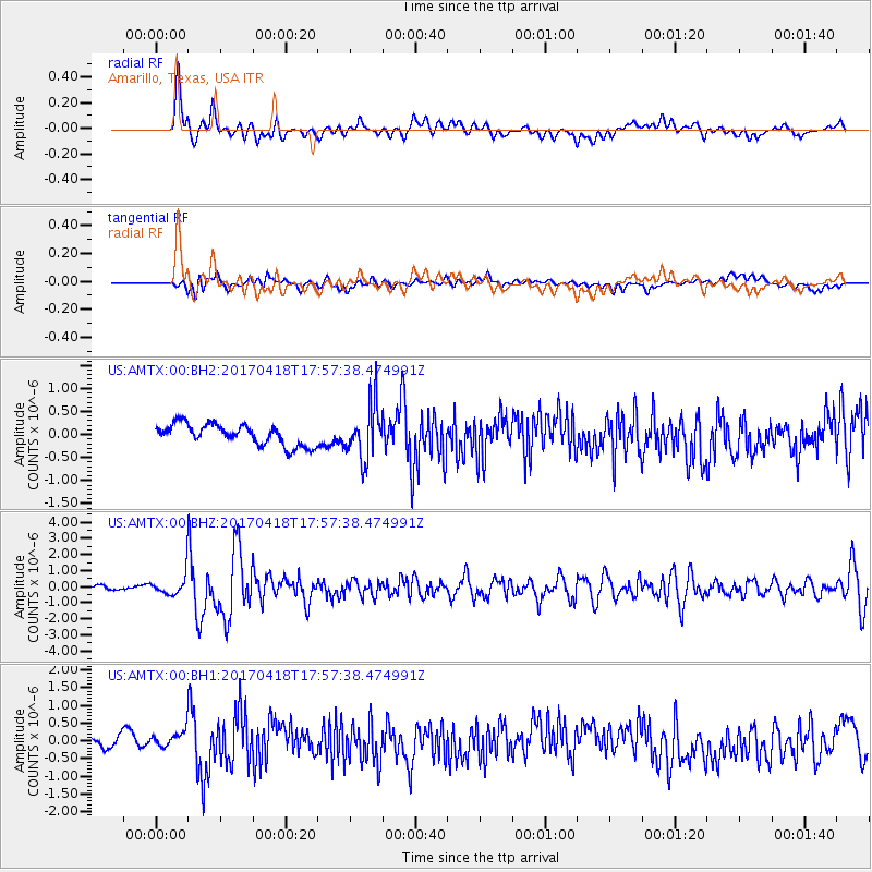
Signal To Noise
| Channel | StoN | STA | LTA |
| US:AMTX:00:BHZ:20170418T17:57:38.474991Z | 4.769913 | 6.7758884E-7 | 1.4205476E-7 |
| US:AMTX:00:BH1:20170418T17:57:38.474991Z | 1.9178553 | 3.4114865E-7 | 1.778803E-7 |
| US:AMTX:00:BH2:20170418T17:57:38.474991Z | 1.1640071 | 2.4606732E-7 | 2.1139677E-7 |
| Arrivals |
| Ps | |
| PpPs | |
| PsPs/PpSs | |


