TIR Tirana, Albania - Earthquake Result Viewer
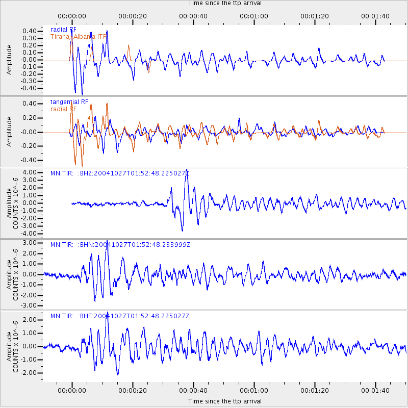
Earthquake location: Near West Coast Of Honshu, Japan
Earthquake latitude/longitude: 37.3/138.9
Earthquake time(UTC): 2004/10/27 (301) 01:40:50 GMT
Earthquake Depth: 14 km
Earthquake Magnitude: 5.7 MB, 5.4 MS, 6.0 MW, 5.9 MW
Earthquake Catalog/Contributor: WHDF/NEIC
Network: MN MEDNET Project
Station: TIR Tirana, Albania
Lat/Lon: 41.35 N/19.86 E
Elevation: 247 m
Distance: 83.9 deg
Az: 318.541 deg
Baz: 44.537 deg
Ray Param: 0.045825668
Estimated Moho Depth: 13.25 km
Estimated Crust Vp/Vs: 1.97
Assumed Crust Vp: 5.967 km/s
Estimated Crust Vs: 3.033 km/s
Estimated Crust Poisson's Ratio: 0.33
Radial Match: 86.44253 %
Radial Bump: 400
Transverse Match: 86.65451 %
Transverse Bump: 400
SOD ConfigId: 2459
Insert Time: 2010-03-08 17:24:35.462 +0000
GWidth: 2.5
Max Bumps: 400
Tol: 0.001

Signal To Noise

ChannelStoNSTALTA
MN:TIR: :BHN:20041027T01:52:48.233999Z2.92144043.715292E-71.271733E-7
MN:TIR: :BHE:20041027T01:52:48.225027Z2.23879773.3994516E-71.5184274E-7
MN:TIR: :BHZ:20041027T01:52:48.225027Z5.85602248.5806215E-71.4652646E-7
Arrivals
Ps2.2 SECOND
PpPs6.5 SECOND
PsPs/PpSs8.7 SECOND