
TIR Tirana, Albania - Earthquake Result Viewer
| ||||||||||||||||||
| ||||||||||||||||||
| ||||||||||||||||||
|
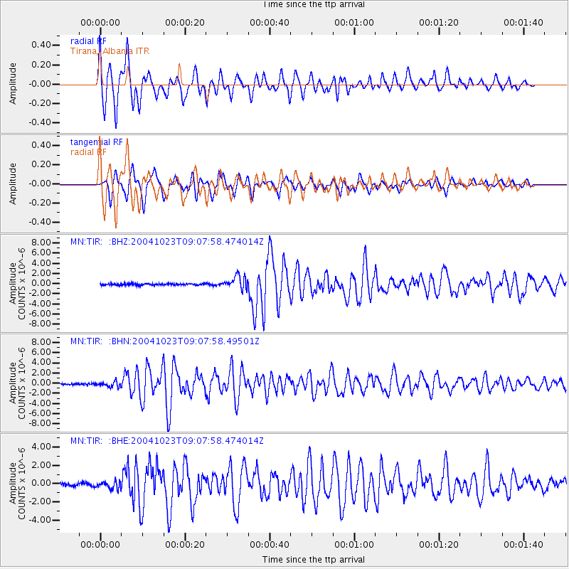
Signal To Noise
| Channel | StoN | STA | LTA |
| MN:TIR: :BHN:20041023T09:07:58.49501Z | 3.285695 | 5.002749E-7 | 1.5225845E-7 |
| MN:TIR: :BHE:20041023T09:07:58.474014Z | 2.4641848 | 4.0626534E-7 | 1.6486806E-7 |
| MN:TIR: :BHZ:20041023T09:07:58.474014Z | 8.784889 | 1.2850937E-6 | 1.4628456E-7 |
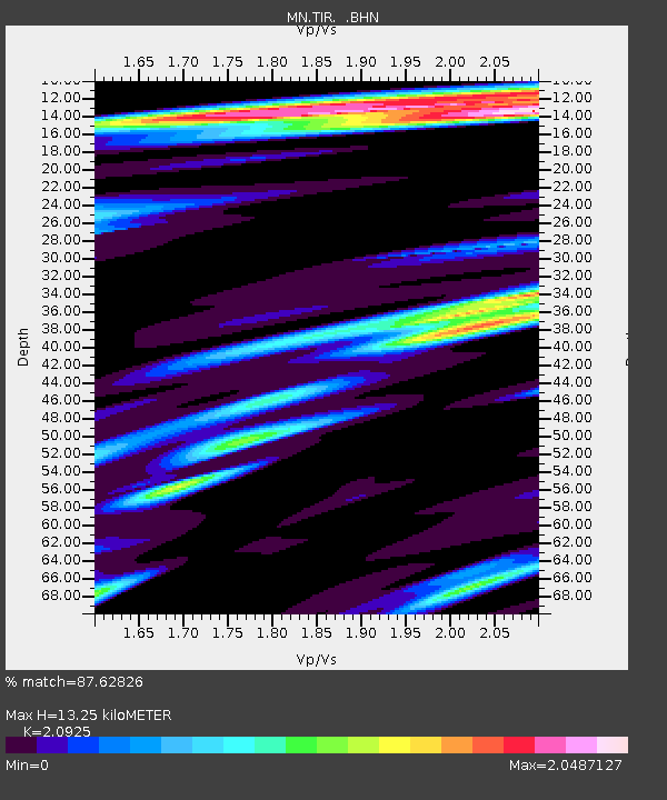
| Arrivals | |
| Ps | 2.5 SECOND |
| PpPs | 6.7 SECOND |
| PsPs/PpSs | 9.2 SECOND |

