
TIR Tirana, Albania - Earthquake Result Viewer
| ||||||||||||||||||
| ||||||||||||||||||
| ||||||||||||||||||
|
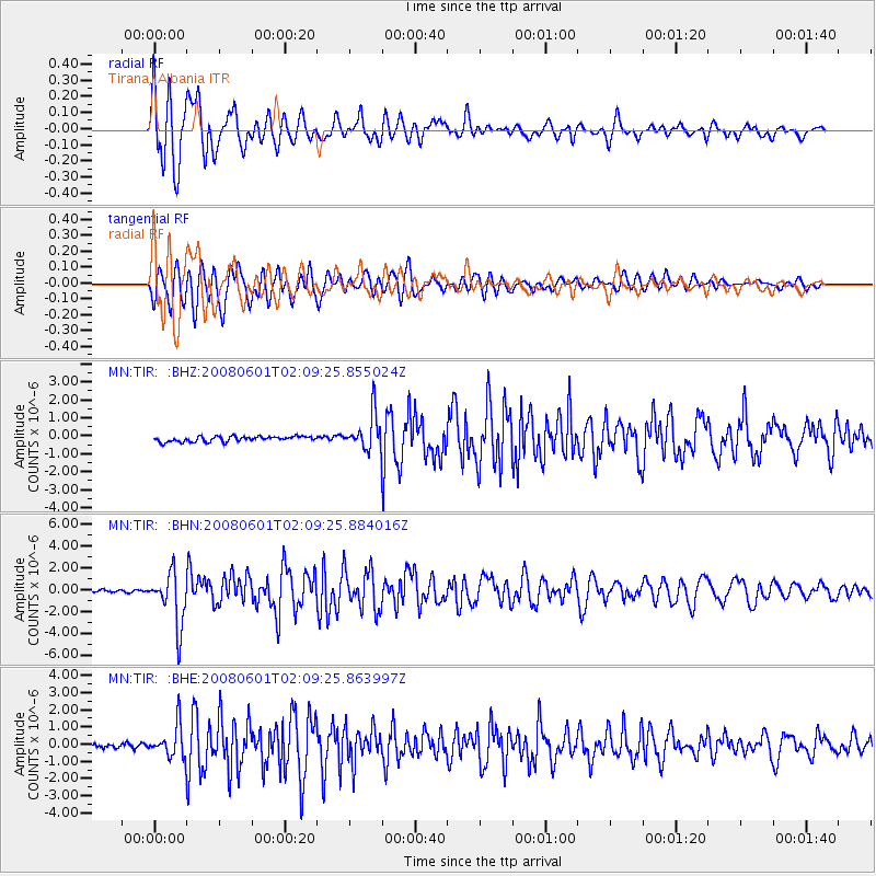
Signal To Noise
| Channel | StoN | STA | LTA |
| MN:TIR: :BHN:20080601T02:09:25.884016Z | 20.598852 | 2.404456E-6 | 1.1672766E-7 |
| MN:TIR: :BHE:20080601T02:09:25.863997Z | 8.8036375 | 9.327387E-7 | 1.0594923E-7 |
| MN:TIR: :BHZ:20080601T02:09:25.855024Z | 6.639139 | 9.860345E-7 | 1.4851842E-7 |
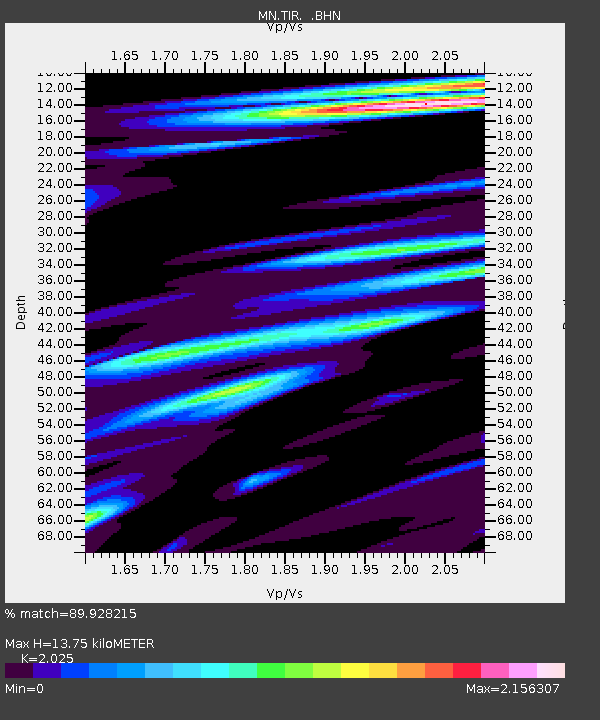
| Arrivals | |
| Ps | 2.4 SECOND |
| PpPs | 6.8 SECOND |
| PsPs/PpSs | 9.3 SECOND |

