You are here: Home > Network List > US - United States National Seismic Network Stations List
> Station EGMT Eagleton, Montana, USA > Earthquake Result Viewer
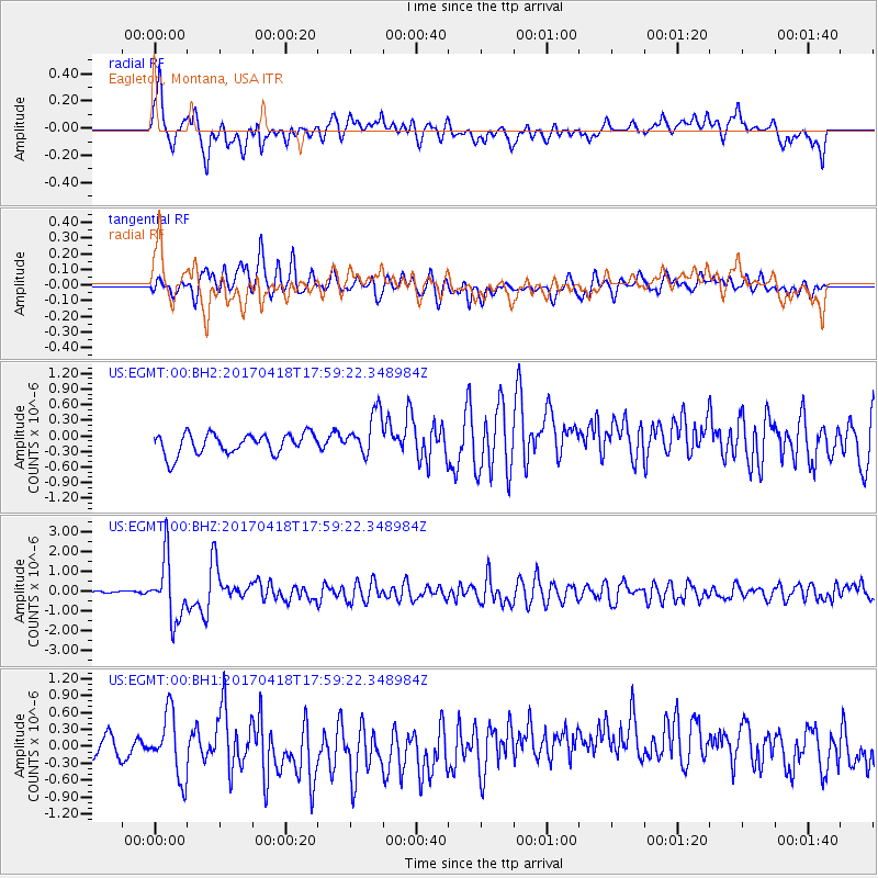
EGMT Eagleton, Montana, USA - Earthquake Result Viewer
*The percent match for this event was below the threshold and hence no stack was calculated.
| Earthquake location: |
Peru-Ecuador Border Region |
| Earthquake latitude/longitude: |
-2.7/-75.3 |
| Earthquake time(UTC): |
2017/04/18 (108) 17:49:55 GMT |
| Earthquake Depth: |
11 km |
| Earthquake Magnitude: |
6.0 Mww |
| Earthquake Catalog/Contributor: |
NEIC PDE/us |
|
| Network: |
US United States National Seismic Network |
| Station: |
EGMT Eagleton, Montana, USA |
| Lat/Lon: |
48.02 N/109.75 W |
| Elevation: |
1055 m |
|
| Distance: |
58.8 deg |
| Az: |
333.646 deg |
| Baz: |
138.658 deg |
| Ray Param: |
$rayparam |
*The percent match for this event was below the threshold and hence was not used in the summary stack. |
|
| Radial Match: |
58.35885 % |
| Radial Bump: |
400 |
| Transverse Match: |
68.05844 % |
| Transverse Bump: |
400 |
| SOD ConfigId: |
2028011 |
| Insert Time: |
2017-05-02 17:57:11.977 +0000 |
| GWidth: |
2.5 |
| Max Bumps: |
400 |
| Tol: |
0.001 |
|
Signal To Noise
| Channel | StoN | STA | LTA |
| US:EGMT:00:BHZ:20170418T17:59:22.348984Z | 14.04829 | 1.52753E-6 | 1.0873423E-7 |
| US:EGMT:00:BH1:20170418T17:59:22.348984Z | 2.8152788 | 5.6456247E-7 | 2.005352E-7 |
| US:EGMT:00:BH2:20170418T17:59:22.348984Z | 2.0907762 | 4.1596542E-7 | 1.9895262E-7 |
| Arrivals |
| Ps | |
| PpPs | |
| PsPs/PpSs | |


