You are here: Home > Network List > US - United States National Seismic Network Stations List
> Station HAWA Hanford, Washington, USA > Earthquake Result Viewer
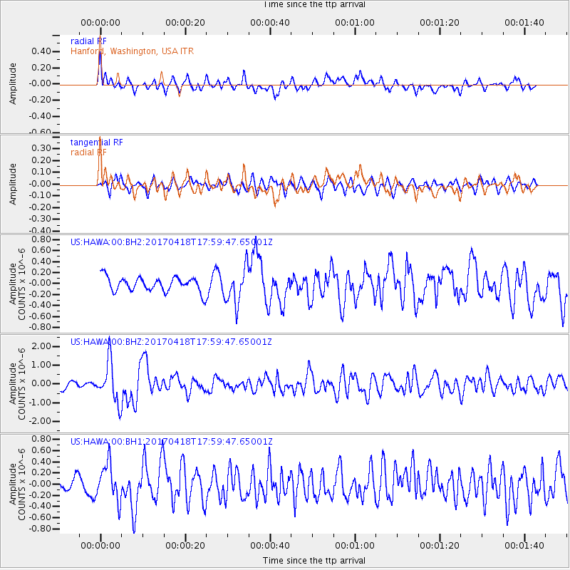
HAWA Hanford, Washington, USA - Earthquake Result Viewer
*The percent match for this event was below the threshold and hence no stack was calculated.
| Earthquake location: |
Peru-Ecuador Border Region |
| Earthquake latitude/longitude: |
-2.7/-75.3 |
| Earthquake time(UTC): |
2017/04/18 (108) 17:49:55 GMT |
| Earthquake Depth: |
11 km |
| Earthquake Magnitude: |
6.0 Mww |
| Earthquake Catalog/Contributor: |
NEIC PDE/us |
|
| Network: |
US United States National Seismic Network |
| Station: |
HAWA Hanford, Washington, USA |
| Lat/Lon: |
46.39 N/119.53 W |
| Elevation: |
364 m |
|
| Distance: |
62.5 deg |
| Az: |
327.035 deg |
| Baz: |
128.254 deg |
| Ray Param: |
$rayparam |
*The percent match for this event was below the threshold and hence was not used in the summary stack. |
|
| Radial Match: |
67.365265 % |
| Radial Bump: |
400 |
| Transverse Match: |
61.279682 % |
| Transverse Bump: |
400 |
| SOD ConfigId: |
2028011 |
| Insert Time: |
2017-05-02 17:57:20.299 +0000 |
| GWidth: |
2.5 |
| Max Bumps: |
400 |
| Tol: |
0.001 |
|
Signal To Noise
| Channel | StoN | STA | LTA |
| US:HAWA:00:BHZ:20170418T17:59:47.65001Z | 4.7607765 | 1.1167239E-6 | 2.3456758E-7 |
| US:HAWA:00:BH1:20170418T17:59:47.65001Z | 2.1966434 | 3.3212686E-7 | 1.5119745E-7 |
| US:HAWA:00:BH2:20170418T17:59:47.65001Z | 2.5602417 | 3.3565735E-7 | 1.3110377E-7 |
| Arrivals |
| Ps | |
| PpPs | |
| PsPs/PpSs | |


