TIR Tirana, Albania - Earthquake Result Viewer
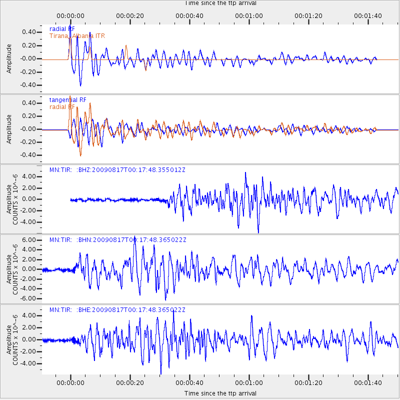
Earthquake location: Southwestern Ryukyu Isl., Japan
Earthquake latitude/longitude: 23.5/123.5
Earthquake time(UTC): 2009/08/17 (229) 00:05:49 GMT
Earthquake Depth: 20 km
Earthquake Magnitude: 6.2 MB, 6.6 MS, 6.7 MW, 6.6 MW
Earthquake Catalog/Contributor: WHDF/NEIC
Network: MN MEDNET Project
Station: TIR Tirana, Albania
Lat/Lon: 41.35 N/19.86 E
Elevation: 247 m
Distance: 84.4 deg
Az: 312.673 deg
Baz: 63.698 deg
Ray Param: 0.045510136
Estimated Moho Depth: 13.5 km
Estimated Crust Vp/Vs: 2.06
Assumed Crust Vp: 5.967 km/s
Estimated Crust Vs: 2.893 km/s
Estimated Crust Poisson's Ratio: 0.35
Radial Match: 94.21768 %
Radial Bump: 400
Transverse Match: 85.05769 %
Transverse Bump: 400
SOD ConfigId: 2622
Insert Time: 2010-03-08 17:25:17.971 +0000
GWidth: 2.5
Max Bumps: 400
Tol: 0.001

Signal To Noise

ChannelStoNSTALTA
MN:TIR: :BHN:20090817T00:17:48.365022Z7.43134361.1747541E-61.5808098E-7
MN:TIR: :BHE:20090817T00:17:48.365022Z3.0238554.1450755E-71.3707917E-7
MN:TIR: :BHZ:20090817T00:17:48.355012Z3.8248394.964052E-71.2978461E-7
Arrivals
Ps2.4 SECOND
PpPs6.8 SECOND
PsPs/PpSs9.3 SECOND