You are here: Home > Network List > US - United States National Seismic Network Stations List
> Station LKWY Lake (Yellowstone--Lake), Wyoming, USA > Earthquake Result Viewer
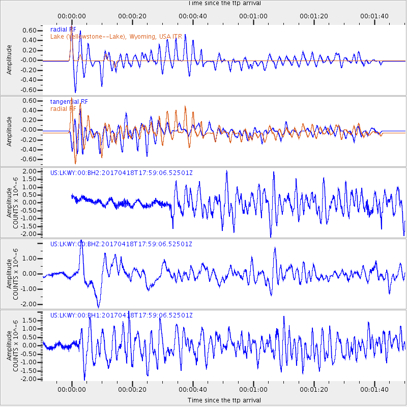
LKWY Lake (Yellowstone--Lake), Wyoming, USA - Earthquake Result Viewer
*The percent match for this event was below the threshold and hence no stack was calculated.
| Earthquake location: |
Peru-Ecuador Border Region |
| Earthquake latitude/longitude: |
-2.7/-75.3 |
| Earthquake time(UTC): |
2017/04/18 (108) 17:49:55 GMT |
| Earthquake Depth: |
11 km |
| Earthquake Magnitude: |
6.0 Mww |
| Earthquake Catalog/Contributor: |
NEIC PDE/us |
|
| Network: |
US United States National Seismic Network |
| Station: |
LKWY Lake (Yellowstone--Lake), Wyoming, USA |
| Lat/Lon: |
44.57 N/110.40 W |
| Elevation: |
2424 m |
|
| Distance: |
56.6 deg |
| Az: |
330.493 deg |
| Baz: |
136.507 deg |
| Ray Param: |
$rayparam |
*The percent match for this event was below the threshold and hence was not used in the summary stack. |
|
| Radial Match: |
74.03034 % |
| Radial Bump: |
400 |
| Transverse Match: |
66.768745 % |
| Transverse Bump: |
400 |
| SOD ConfigId: |
2028011 |
| Insert Time: |
2017-05-02 17:57:38.838 +0000 |
| GWidth: |
2.5 |
| Max Bumps: |
400 |
| Tol: |
0.001 |
|
Signal To Noise
| Channel | StoN | STA | LTA |
| US:LKWY:00:BHZ:20170418T17:59:06.52501Z | 9.466374 | 8.7281467E-7 | 9.220158E-8 |
| US:LKWY:00:BH1:20170418T17:59:06.52501Z | 4.7804437 | 7.1368936E-7 | 1.4929354E-7 |
| US:LKWY:00:BH2:20170418T17:59:06.52501Z | 3.0100086 | 6.0387606E-7 | 2.0062271E-7 |
| Arrivals |
| Ps | |
| PpPs | |
| PsPs/PpSs | |


