You are here: Home > Network List > UU - University of Utah Regional Network Stations List
> Station FORU South Mineral Mountains, UT, USA > Earthquake Result Viewer
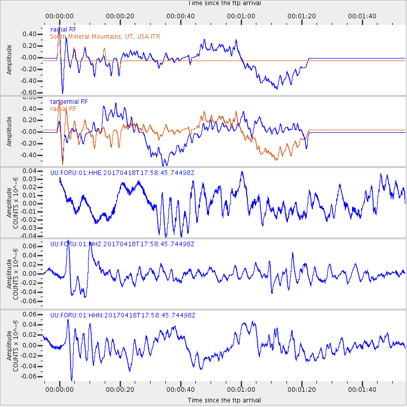
FORU South Mineral Mountains, UT, USA - Earthquake Result Viewer
*The percent match for this event was below the threshold and hence no stack was calculated.
| Earthquake location: |
Peru-Ecuador Border Region |
| Earthquake latitude/longitude: |
-2.7/-75.3 |
| Earthquake time(UTC): |
2017/04/18 (108) 17:49:55 GMT |
| Earthquake Depth: |
11 km |
| Earthquake Magnitude: |
6.0 Mww |
| Earthquake Catalog/Contributor: |
NEIC PDE/us |
|
| Network: |
UU University of Utah Regional Network |
| Station: |
FORU South Mineral Mountains, UT, USA |
| Lat/Lon: |
38.46 N/112.86 W |
| Elevation: |
1840 m |
|
| Distance: |
53.7 deg |
| Az: |
323.559 deg |
| Baz: |
130.909 deg |
| Ray Param: |
$rayparam |
*The percent match for this event was below the threshold and hence was not used in the summary stack. |
|
| Radial Match: |
61.63485 % |
| Radial Bump: |
400 |
| Transverse Match: |
58.170776 % |
| Transverse Bump: |
400 |
| SOD ConfigId: |
2028011 |
| Insert Time: |
2017-05-02 17:58:28.431 +0000 |
| GWidth: |
2.5 |
| Max Bumps: |
400 |
| Tol: |
0.001 |
|
Signal To Noise
| Channel | StoN | STA | LTA |
| UU:FORU:01:HHZ:20170418T17:58:45.74498Z | 5.4552107 | 3.208757E-8 | 5.8820033E-9 |
| UU:FORU:01:HHN:20170418T17:58:45.74498Z | 1.128655 | 2.7086779E-8 | 2.3999167E-8 |
| UU:FORU:01:HHE:20170418T17:58:45.74498Z | 1.059449 | 1.5840294E-8 | 1.4951446E-8 |
| Arrivals |
| Ps | |
| PpPs | |
| PsPs/PpSs | |


