You are here: Home > Network List > WY - Yellowstone Wyoming Seismic Network Stations List
> Station YUF Upper Falls, WY, USA > Earthquake Result Viewer
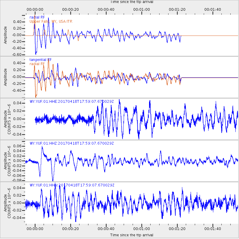
YUF Upper Falls, WY, USA - Earthquake Result Viewer
*The percent match for this event was below the threshold and hence no stack was calculated.
| Earthquake location: |
Peru-Ecuador Border Region |
| Earthquake latitude/longitude: |
-2.7/-75.3 |
| Earthquake time(UTC): |
2017/04/18 (108) 17:49:55 GMT |
| Earthquake Depth: |
11 km |
| Earthquake Magnitude: |
6.0 Mww |
| Earthquake Catalog/Contributor: |
NEIC PDE/us |
|
| Network: |
WY Yellowstone Wyoming Seismic Network |
| Station: |
YUF Upper Falls, WY, USA |
| Lat/Lon: |
44.71 N/110.51 W |
| Elevation: |
2394 m |
|
| Distance: |
56.7 deg |
| Az: |
330.546 deg |
| Baz: |
136.458 deg |
| Ray Param: |
$rayparam |
*The percent match for this event was below the threshold and hence was not used in the summary stack. |
|
| Radial Match: |
77.41613 % |
| Radial Bump: |
400 |
| Transverse Match: |
74.12053 % |
| Transverse Bump: |
400 |
| SOD ConfigId: |
2028011 |
| Insert Time: |
2017-05-02 17:59:30.912 +0000 |
| GWidth: |
2.5 |
| Max Bumps: |
400 |
| Tol: |
0.001 |
|
Signal To Noise
| Channel | StoN | STA | LTA |
| WY:YUF:01:HHZ:20170418T17:59:07.670029Z | 8.151871 | 3.0643644E-8 | 3.7590935E-9 |
| WY:YUF:01:HHN:20170418T17:59:07.670029Z | 2.019108 | 1.4620715E-8 | 7.2411748E-9 |
| WY:YUF:01:HHE:20170418T17:59:07.670029Z | 2.236107 | 1.27152076E-8 | 5.6863136E-9 |
| Arrivals |
| Ps | |
| PpPs | |
| PsPs/PpSs | |


