TRI Trieste, Italy - Earthquake Result Viewer
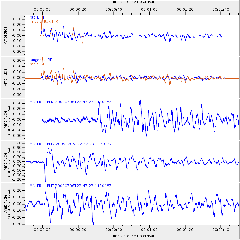
Earthquake location: Southeast Of Ryukyu Islands
Earthquake latitude/longitude: 24.9/128.0
Earthquake time(UTC): 2009/07/06 (187) 22:35:05 GMT
Earthquake Depth: 10 km
Earthquake Magnitude: 6.1 MB, 5.3 MS, 5.7 MW, 5.7 MW
Earthquake Catalog/Contributor: WHDF/NEIC
Network: MN MEDNET Project
Station: TRI Trieste, Italy
Lat/Lon: 45.71 N/13.76 E
Elevation: 161 m
Distance: 87.9 deg
Az: 320.265 deg
Baz: 55.959 deg
Ray Param: 0.042997643
Estimated Moho Depth: 12.75 km
Estimated Crust Vp/Vs: 1.61
Assumed Crust Vp: 6.207 km/s
Estimated Crust Vs: 3.861 km/s
Estimated Crust Poisson's Ratio: 0.18
Radial Match: 86.56779 %
Radial Bump: 400
Transverse Match: 75.14279 %
Transverse Bump: 400
SOD ConfigId: 2648
Insert Time: 2010-03-08 17:27:36.694 +0000
GWidth: 2.5
Max Bumps: 400
Tol: 0.001

Signal To Noise

ChannelStoNSTALTA
MN:TRI: :BHN:20090706T22:47:23.113018Z14.1910486.041499E-74.2572605E-8
MN:TRI: :BHE:20090706T22:47:23.113018Z3.22073171.0626135E-73.2992926E-8
MN:TRI: :BHZ:20090706T22:47:23.113018Z5.5100231.4199775E-72.5770806E-8
Arrivals
Ps1.3 SECOND
PpPs5.2 SECOND
PsPs/PpSs6.5 SECOND