You are here: Home > Network List > US - United States National Seismic Network Stations List
> Station HAWA Hanford, Washington, USA > Earthquake Result Viewer
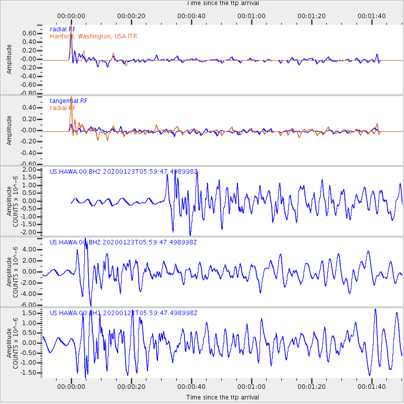
HAWA Hanford, Washington, USA - Earthquake Result Viewer
*The percent match for this event was below the threshold and hence no stack was calculated.
| Earthquake location: |
Andreanof Islands, Aleutian Is. |
| Earthquake latitude/longitude: |
51.9/-177.8 |
| Earthquake time(UTC): |
2020/01/23 (023) 05:53:03 GMT |
| Earthquake Depth: |
10 km |
| Earthquake Magnitude: |
6.2 Mw |
| Earthquake Catalog/Contributor: |
NEIC PDE/us |
|
| Network: |
US United States National Seismic Network |
| Station: |
HAWA Hanford, Washington, USA |
| Lat/Lon: |
46.39 N/119.53 W |
| Elevation: |
364 m |
|
| Distance: |
37.6 deg |
| Az: |
74.671 deg |
| Baz: |
300.348 deg |
| Ray Param: |
$rayparam |
*The percent match for this event was below the threshold and hence was not used in the summary stack. |
|
| Radial Match: |
79.83721 % |
| Radial Bump: |
400 |
| Transverse Match: |
60.027145 % |
| Transverse Bump: |
400 |
| SOD ConfigId: |
20465011 |
| Insert Time: |
2020-02-06 06:19:10.417 +0000 |
| GWidth: |
2.5 |
| Max Bumps: |
400 |
| Tol: |
0.001 |
|
Signal To Noise
| Channel | StoN | STA | LTA |
| US:HAWA:00:BHZ:20200123T05:59:47.498998Z | 7.617804 | 2.4984674E-6 | 3.2797738E-7 |
| US:HAWA:00:BH1:20200123T05:59:47.498998Z | 2.1036866 | 7.6475055E-7 | 3.6352873E-7 |
| US:HAWA:00:BH2:20200123T05:59:47.498998Z | 6.999827 | 9.006603E-7 | 1.2866894E-7 |
| Arrivals |
| Ps | |
| PpPs | |
| PsPs/PpSs | |


