You are here: Home > Network List > IU - Global Seismograph Network (GSN - IRIS/USGS) Stations List
> Station MAKZ Makanchi, Kazakhstan > Earthquake Result Viewer
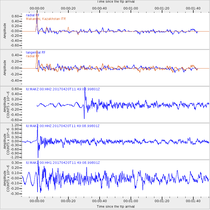
MAKZ Makanchi, Kazakhstan - Earthquake Result Viewer
*The percent match for this event was below the threshold and hence no stack was calculated.
| Earthquake location: |
Kuril Islands |
| Earthquake latitude/longitude: |
44.4/148.7 |
| Earthquake time(UTC): |
2017/04/20 (110) 11:41:26 GMT |
| Earthquake Depth: |
61 km |
| Earthquake Magnitude: |
5.5 mb |
| Earthquake Catalog/Contributor: |
NEIC PDE/us |
|
| Network: |
IU Global Seismograph Network (GSN - IRIS/USGS) |
| Station: |
MAKZ Makanchi, Kazakhstan |
| Lat/Lon: |
46.81 N/81.98 E |
| Elevation: |
600 m |
|
| Distance: |
45.5 deg |
| Az: |
297.717 deg |
| Baz: |
67.427 deg |
| Ray Param: |
$rayparam |
*The percent match for this event was below the threshold and hence was not used in the summary stack. |
|
| Radial Match: |
61.73538 % |
| Radial Bump: |
400 |
| Transverse Match: |
56.891403 % |
| Transverse Bump: |
400 |
| SOD ConfigId: |
2028011 |
| Insert Time: |
2017-05-04 11:44:45.229 +0000 |
| GWidth: |
2.5 |
| Max Bumps: |
400 |
| Tol: |
0.001 |
|
Signal To Noise
| Channel | StoN | STA | LTA |
| IU:MAKZ:00:HHZ:20170420T11:49:08.99801Z | 6.043921 | 4.233012E-7 | 7.0037515E-8 |
| IU:MAKZ:00:HH1:20170420T11:49:08.99801Z | 3.4385386 | 1.5367462E-7 | 4.4691838E-8 |
| IU:MAKZ:00:HH2:20170420T11:49:08.99801Z | 5.5088825 | 2.0968855E-7 | 3.8063718E-8 |
| Arrivals |
| Ps | |
| PpPs | |
| PsPs/PpSs | |


