You are here: Home > Network List > TA - USArray Transportable Network (new EarthScope stations) Stations List
> Station POKR Poker Plat Research Range, AK, USA > Earthquake Result Viewer
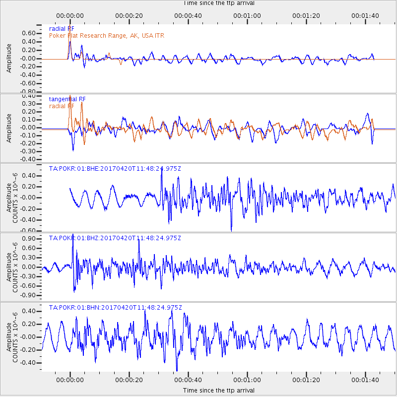
POKR Poker Plat Research Range, AK, USA - Earthquake Result Viewer
*The percent match for this event was below the threshold and hence no stack was calculated.
| Earthquake location: |
Kuril Islands |
| Earthquake latitude/longitude: |
44.4/148.7 |
| Earthquake time(UTC): |
2017/04/20 (110) 11:41:26 GMT |
| Earthquake Depth: |
61 km |
| Earthquake Magnitude: |
5.5 mb |
| Earthquake Catalog/Contributor: |
NEIC PDE/us |
|
| Network: |
TA USArray Transportable Network (new EarthScope stations) |
| Station: |
POKR Poker Plat Research Range, AK, USA |
| Lat/Lon: |
65.12 N/147.43 W |
| Elevation: |
501 m |
|
| Distance: |
40.0 deg |
| Az: |
36.19 deg |
| Baz: |
270.792 deg |
| Ray Param: |
$rayparam |
*The percent match for this event was below the threshold and hence was not used in the summary stack. |
|
| Radial Match: |
46.603165 % |
| Radial Bump: |
400 |
| Transverse Match: |
32.174576 % |
| Transverse Bump: |
334 |
| SOD ConfigId: |
2028011 |
| Insert Time: |
2017-05-04 11:46:22.173 +0000 |
| GWidth: |
2.5 |
| Max Bumps: |
400 |
| Tol: |
0.001 |
|
Signal To Noise
| Channel | StoN | STA | LTA |
| TA:POKR:01:BHZ:20170420T11:48:24.975Z | 4.3802533 | 3.6357108E-7 | 8.300229E-8 |
| TA:POKR:01:BHN:20170420T11:48:24.975Z | 0.9877899 | 1.5595676E-7 | 1.5788453E-7 |
| TA:POKR:01:BHE:20170420T11:48:24.975Z | 1.8408387 | 1.9725582E-7 | 1.071554E-7 |
| Arrivals |
| Ps | |
| PpPs | |
| PsPs/PpSs | |


