You are here: Home > Network List > US - United States National Seismic Network Stations List
> Station ERPA Erie, Pennsylvania, USA > Earthquake Result Viewer
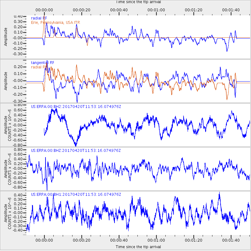
ERPA Erie, Pennsylvania, USA - Earthquake Result Viewer
*The percent match for this event was below the threshold and hence no stack was calculated.
| Earthquake location: |
Kuril Islands |
| Earthquake latitude/longitude: |
44.4/148.7 |
| Earthquake time(UTC): |
2017/04/20 (110) 11:41:26 GMT |
| Earthquake Depth: |
61 km |
| Earthquake Magnitude: |
5.5 mb |
| Earthquake Catalog/Contributor: |
NEIC PDE/us |
|
| Network: |
US United States National Seismic Network |
| Station: |
ERPA Erie, Pennsylvania, USA |
| Lat/Lon: |
42.12 N/79.99 W |
| Elevation: |
306 m |
|
| Distance: |
83.4 deg |
| Az: |
34.251 deg |
| Baz: |
327.181 deg |
| Ray Param: |
$rayparam |
*The percent match for this event was below the threshold and hence was not used in the summary stack. |
|
| Radial Match: |
61.97843 % |
| Radial Bump: |
400 |
| Transverse Match: |
59.038284 % |
| Transverse Bump: |
400 |
| SOD ConfigId: |
2028011 |
| Insert Time: |
2017-05-04 11:46:40.627 +0000 |
| GWidth: |
2.5 |
| Max Bumps: |
400 |
| Tol: |
0.001 |
|
Signal To Noise
| Channel | StoN | STA | LTA |
| US:ERPA:00:BHZ:20170420T11:53:16.074976Z | 2.0727456 | 4.2982464E-7 | 2.0736971E-7 |
| US:ERPA:00:BH1:20170420T11:53:16.074976Z | 0.89600194 | 1.8437049E-7 | 2.0577019E-7 |
| US:ERPA:00:BH2:20170420T11:53:16.074976Z | 0.6496922 | 2.5005596E-7 | 3.8488375E-7 |
| Arrivals |
| Ps | |
| PpPs | |
| PsPs/PpSs | |


