TRI Trieste, Italy - Earthquake Result Viewer
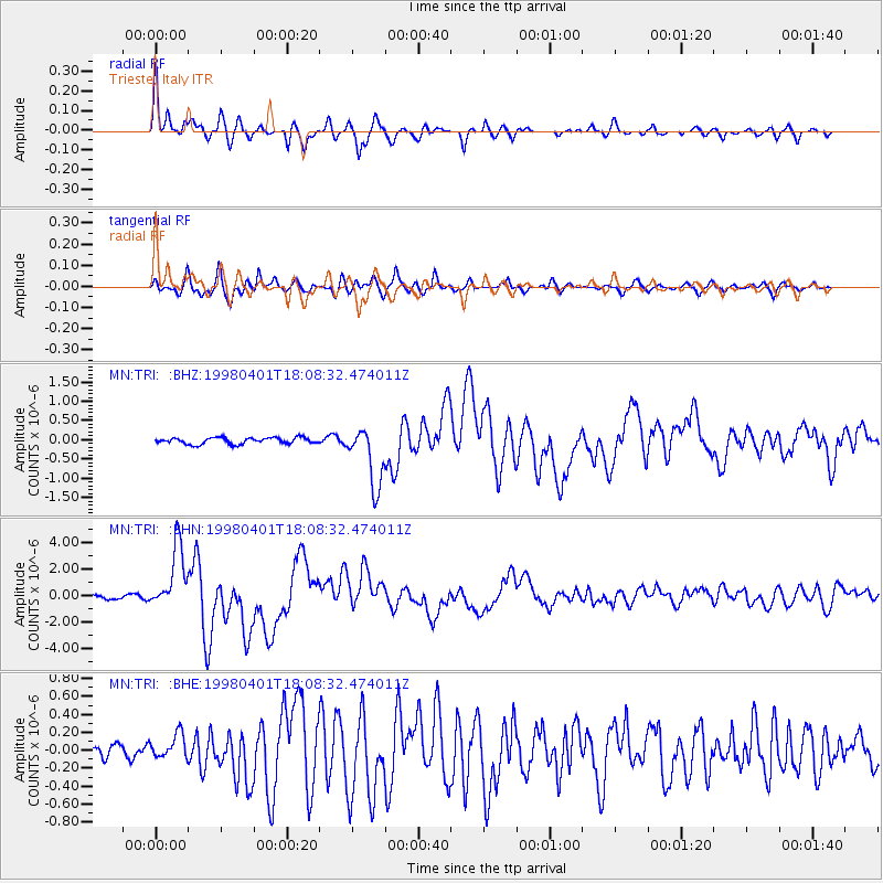
Earthquake location: Southern Sumatra, Indonesia
Earthquake latitude/longitude: -0.5/99.3
Earthquake time(UTC): 1998/04/01 (091) 17:56:23 GMT
Earthquake Depth: 56 km
Earthquake Magnitude: 6.2 MB, 6.9 MS, 7.0 UNKNOWN, 6.6 ME
Earthquake Catalog/Contributor: WHDF/NEIC
Network: MN MEDNET Project
Station: TRI Trieste, Italy
Lat/Lon: 45.71 N/13.76 E
Elevation: 161 m
Distance: 87.2 deg
Az: 315.625 deg
Baz: 93.594 deg
Ray Param: 0.04337444
Estimated Moho Depth: 53.75 km
Estimated Crust Vp/Vs: 2.10
Assumed Crust Vp: 6.207 km/s
Estimated Crust Vs: 2.959 km/s
Estimated Crust Poisson's Ratio: 0.35
Radial Match: 88.8892 %
Radial Bump: 400
Transverse Match: 79.95495 %
Transverse Bump: 400
SOD ConfigId: 4480
Insert Time: 2010-03-08 17:28:40.604 +0000
GWidth: 2.5
Max Bumps: 400
Tol: 0.001

Signal To Noise

ChannelStoNSTALTA
MN:TRI: :BHN:19980401T18:08:32.474011Z17.0106432.369961E-61.3932225E-7
MN:TRI: :BHE:19980401T18:08:32.474011Z2.00945381.3607169E-76.771576E-8
MN:TRI: :BHZ:19980401T18:08:32.474011Z9.6083837.8321756E-78.151398E-8
Arrivals
Ps9.7 SECOND
PpPs26 SECOND
PsPs/PpSs36 SECOND